Lunar Reconnaissance Orbiter in 2026: Real Moon Photos, Seven Instruments and South Pole Maps

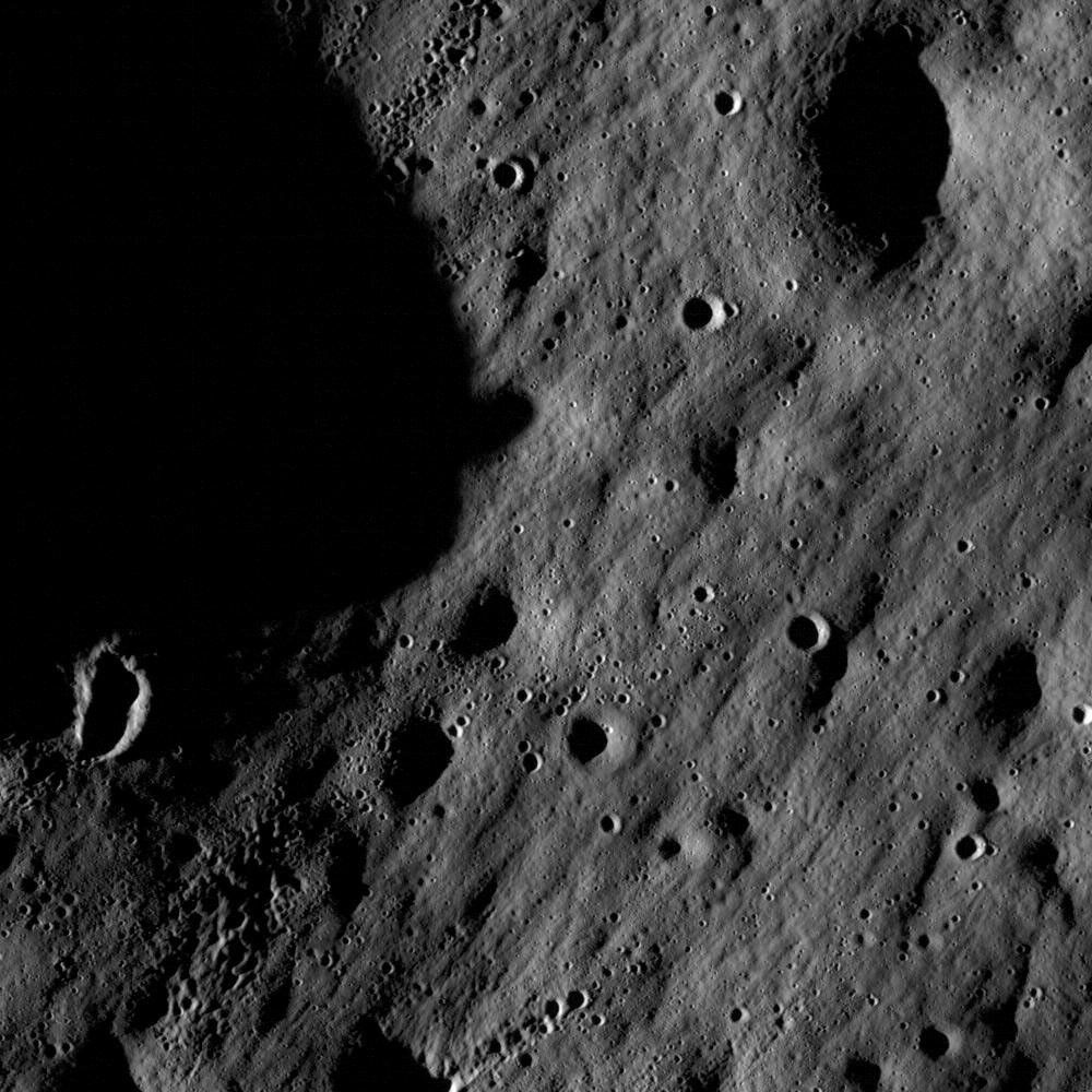
Quick answer — reviewed October 15, 2026: NASA’s Lunar Reconnaissance Orbiter (LRO) has studied the Moon from orbit since June 2009 and remains an active science mission. Its seven main instruments map lunar terrain, temperatures, radiation and possible polar resources. The real photograph below was taken by LRO’s Narrow Angle Camera, not digitally invented.
Lunar Reconnaissance Orbiter at a glance
| Feature | Verified information |
|---|---|
| Launch date | June 18, 2009 |
| Arrival at Moon | June 23, 2009 |
| Destination | Lunar orbit |
| Mission status in 2026 | Active per NASA’s mission portal |
| Major science goals | Surface mapping, polar lighting, temperatures, resources and radiation |
| Instrument suite | LROC, LOLA, Diviner, LAMP, LEND, Mini-RF and CRaTER |
| Photograph shown | Real lunar surface, LROC Narrow Angle Camera (PIA12884) |
What is the Lunar Reconnaissance Orbiter?
NASA’s Lunar Reconnaissance Orbiter, or LRO, is an uncrewed spacecraft that has mapped and studied the Moon from lunar orbit since 2009. It was designed to provide high-resolution pictures, measurements of terrain and temperature, studies of radiation, and information that future spacecraft and astronauts can use when choosing landing locations. NASA still lists it as an active mission in 2026. That extraordinary longevity is a major part of the story: a mission initially planned around a one-year exploration phase grew into a continuing source of new lunar observations and long-term comparisons.
The 2009 launch and arrival at the Moon
LRO lifted off from Cape Canaveral on June 18, 2009, aboard an Atlas V with the Lunar Crater Observation and Sensing Satellite, or LCROSS. After a flight of several days, LRO entered lunar orbit on June 23. The spacecraft then adjusted its orbit as controllers commissioned the instruments and prepared for detailed surface mapping. Its original mapping phase began later in 2009. These dates are often confused with LCROSS’s later impact experiment, which involved a different spacecraft and purpose. LRO was intended to remain in orbit and observe the Moon, not to deliberately collide with its surface.
What the photograph in this article actually shows
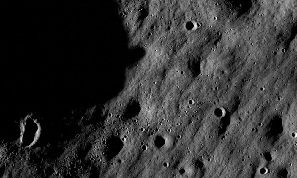
The image accompanying this article is a genuine grayscale image captured by LRO’s Narrow Angle Camera, cataloged as NASA photojournal image PIA12884. It shows impact craters on the lunar surface at high resolution, including individual craters and smaller clusters produced by material thrown out of larger impacts. The imaged scene spans approximately 1,400 meters across in the original description. It is not an artist’s impression of a future lunar base or a picture taken by astronauts with a handheld camera. Separating real spacecraft data from simulated visualizations is essential when judging claims about recent Moon discoveries.
Why lunar orbiting maps are useful for future landings
LRO’s camera and altitude measurements help researchers evaluate terrain that could be hazardous to a lander or astronaut: slopes, boulder fields, crater rims, shadowed depressions and approach corridors. A high-resolution map does not by itself certify every location as safe, but it is an important input to landing-system design and mission planning. NASA highlights this work in connection with the broader Artemis exploration program. Because lighting near the Moon’s poles changes dramatically across short distances, carefully mapped sunlight and shadow patterns are particularly valuable when considering power and thermal conditions.
LROC: two narrow-angle cameras and one wide-angle camera
The Lunar Reconnaissance Orbiter Camera system, usually shortened to LROC, combines two narrow-angle cameras with a wide-angle camera. The narrow-angle system can make highly detailed observations of relatively small surface regions, while the wide-angle system helps place these details in a larger geographic context and characterize changing lighting. This is why an extraordinary close-up of a boulder should be viewed alongside broader mosaics and coordinates. Some LROC views are monochrome, and some products combine information or emphasize differences to reveal physical features. A processed science image is not necessarily what the human eye would see looking through a window.
LOLA: mapping the shape of the lunar landscape
The Lunar Orbiter Laser Altimeter, or LOLA, fires laser pulses toward the Moon and measures returned light to estimate distance. Repeated measurements can help build precise terrain and elevation models across the Moon. Such topographic maps describe whether a route crosses a gentle slope, a crater wall or a complicated ridge. They also help scientists study the Moon’s geological history. A colored height map generated from LOLA data is not a conventional color photograph of the lunar surface; its colors represent measured elevation or other data values.
Diviner: measuring extreme lunar temperatures
The Diviner Lunar Radiometer Experiment measures thermal emission and maps how different places on the lunar surface heat and cool. Sunlit terrain can become very hot, while permanently shadowed polar crater interiors remain much colder. These temperatures influence whether materials can remain stable, how equipment must be designed, and where volatile compounds might accumulate. Thermal maps must be interpreted according to local time, surface properties and observation conditions. A place shown in bright colors on a thermal display is not necessarily glowing visibly to the human eye.
LEND, LAMP, Mini-RF and possible lunar ice
Several LRO instruments help investigate conditions at the poles. The Lunar Exploration Neutron Detector, or LEND, measures neutron behavior associated with hydrogen-bearing material in lunar soil. Lyman-Alpha Mapping Project, or LAMP, uses ultraviolet observations to study very dark environments and surface properties. Mini-RF is a radar experiment that can contribute information about surface and subsurface structure. Together with observations from other missions, these data help scientists investigate regions where water ice may persist. An inferred hydrogen signature is not the same thing as a scoop of pure visible ice, and multiple measurements are needed to interpret what a radar or neutron signal means.
CRaTER and the space-radiation environment
The Cosmic Ray Telescope for the Effects of Radiation, CRaTER, studies radiation that could affect humans and equipment near the Moon. Without Earth’s thick protective atmosphere, radiation hazards deserve careful consideration in mission design. LRO’s measurements help build a more realistic understanding of particle environments in lunar orbit. However, the radiation environment changes with solar activity and location, and one instrument does not provide a complete personal safety forecast for an individual astronaut. Scientists combine observations, models and engineering design rather than treating a single number as a guarantee.
Apollo landing site pictures: what can really be resolved?
Some LRO images document the Apollo landing sites, including the descent stages, disturbed surface and tracks associated with lunar exploration. The spacecraft does not take movie-style close-ups of the astronauts themselves. Even its best images have finite ground resolution and depend on illumination, orbital geometry and image processing. Those observations provide an additional record of real human activity on the Moon, but responsible interpretation should name exactly which hardware or tracks are visible. For the spacecraft that transported people from orbit to the lunar surface, see our Apollo Lunar Module explainer.
What LRO adds to the 2026 Artemis era
NASA’s LRO mission page continues to emphasize South Pole exploration planning, surface temperature data and high-resolution maps. Areas where shadows persist can be scientifically interesting because certain volatiles may survive for long periods, yet the same lighting conditions make power and navigation more complicated. LRO data can help identify candidate regions and support continued study as Artemis and commercial lunar missions develop. A candidate landing site mapped by LRO is not a confirmed future astronaut destination; final plans require additional engineering, scheduling and operational decisions. See also our coverage of Artemis II science data for a different view of NASA’s modern lunar program.
How to find authentic LRO pictures and maps
The best starting point is NASA’s Lunar Reconnaissance Orbiter mission portal, which links to science, instruments and image galleries. NASA’s First LROC Images record provides image PIA12884 along with a description of what is actually visible. Scientific image repositories may offer raw observations, corrected products, mosaics and maps, and those are not interchangeable. Read the image date, instrument, resolution and caption before describing a crater as a newly discovered structure. Old photographs of the spacecraft on Earth should not be mislabeled as pictures of the vehicle flying in lunar orbit.
What the mission does not do
LRO is an orbiter, not a rover on the surface. It does not drill directly into lunar ice or carry people. It can inform research about resources, temperature, terrain and radiation, but claims that it has proved a complete underground ocean or found alien structures need extraordinary evidence. Its photographs also should not be confused with data from NASA’s Jupiter orbiter Juno; each spacecraft observes a different celestial target. For context on how specialized orbital instruments turn remote measurements into discoveries, compare our Juno spacecraft guide.
Frequently asked questions
Is the Lunar Reconnaissance Orbiter still operating in 2026?
NASA lists LRO as active and notes its continued role in lunar science and exploration planning. Consult the live mission status for operational changes.
Does LRO take actual Moon photographs?
Yes. Its LROC instrument has produced extensive real lunar imagery, including the crater photograph accompanying this article.
Does LRO land or carry astronauts?
No. It is an uncrewed lunar orbiter, not a lander or passenger spacecraft.
Can LRO images show Apollo landing equipment?
Some sufficiently detailed observations show landing-site hardware or surface tracks; resolution and lighting limit what can be identified.
Does finding hydrogen mean NASA has confirmed an underground ocean?
No. Hydrogen and radar signals require scientific interpretation and do not demonstrate a large liquid ocean beneath the Moon’s surface.