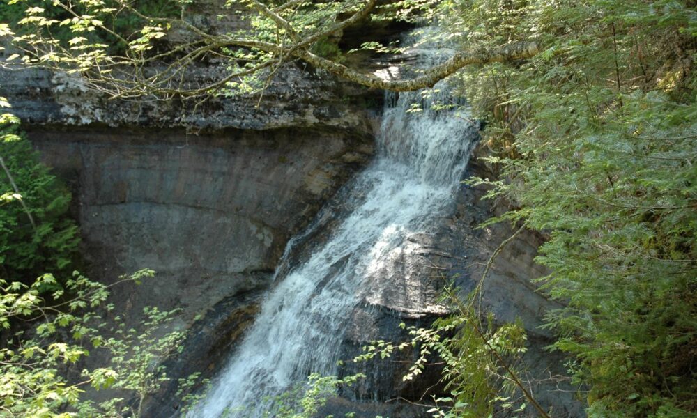

Quick answer — updated October 15, 2026: The Chapel Falls Trail is a forest hike in Pictured Rocks National Lakeshore, Michigan, leading to views of the 60-foot Chapel Falls. The National Park Service lists the waterfall as about 1.2 miles from the Chapel/Mosquito parking lot and the return hike as roughly 2.5 miles round trip. Despite the relatively easy hike, reaching the trailhead can be the hardest part: Chapel Road is an extremely rough five-mile backcountry road with potholes and washouts, and the small parking lot may fill around 9 a.m. in busy seasons. Dogs are not permitted on these trails.
This guide focuses on the waterfall-only visit rather than confusing it with the much longer Chapel Rock, Chapel Beach or Chapel Loop hikes. It covers the right road, the actual trail distance, the two viewpoints, why some maps disagree, how to plan a half-day outing and what the park explicitly warns visitors about.
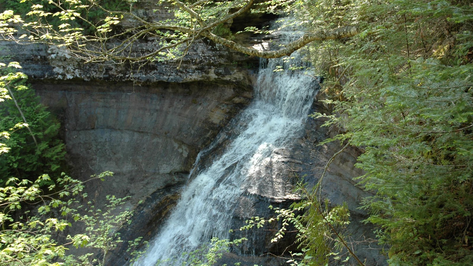
The photograph above is a real National Park Service image of Chapel Falls itself. It is not a photo of Miners Falls, Bridalveil Falls or another Michigan waterfall, and is not computer-generated.
Chapel Falls Trail at a glance
| Item | Answer | Planning note |
|---|---|---|
| Park and state | Pictured Rocks National Lakeshore, Michigan | Upper Peninsula, northeast of Munising |
| Trailhead | Chapel/Mosquito trailhead at end of Chapel Road | Primitive road with deep potholes and washouts |
| Waterfall | Chapel Falls | About 60 feet high |
| Distance | About 2.5 miles round trip | About 1.2 miles each way in NPS place description |
| Difficulty | Easy by NPS hiking classification | Old roadbed with gentle hills; mud and uneven footing possible |
| Scenic access | Two viewing platforms | Stay on trail and at established overlooks |
| Drinking water | Not available at trailhead | Carry sufficient water |
| Restroom | Seasonal vault toilet | Facilities may not be open at all times |
| Dogs and other pets | Prohibited on Chapel-area trails | Includes Chapel Falls, Chapel Rock and Chapel Beach |
| Longer continuation | Chapel Rock and Chapel Beach | About 6.2 miles round trip total from parking |
The official NPS Chapel Falls page gives the 1.2-mile one-way distance, height, parking details and pet restriction. NPS’s Pictured Rocks hiking directory lists the standalone Chapel Falls visit as a 2.5-mile round trip, a rounded estimate consistent with a 1.2-mile walk each way plus minor variation between measurement points.
Where is Chapel Falls in Michigan?
Chapel Falls lies in the forested Chapel Basin of Pictured Rocks National Lakeshore, along Lake Superior in Michigan’s Upper Peninsula. This is not a waterfall on the main road through Munising; visitors must travel roughly 15 miles east of town along Alger County Road H-58 and then follow Chapel Road about five miles north toward the trailhead.
National Park Service directions say the trailhead is roughly 20 miles northeast of Munising overall. Be careful when using a navigation app: the road may appear shorter than the drive actually feels because the final portion is narrow, rough and subject to seasonal damage. It is generally slower than a smooth paved highway.
How do I reach the Chapel Falls parking lot?
- Start in or near Munising: identify Alger County Road H-58, a common eastbound access route for Pictured Rocks destinations.
- Drive toward the Chapel Road turnoff: watch for park signage and follow the official map rather than an unverified shortcut on a forest service road.
- Proceed carefully on Chapel Road: the final five miles are a rough backcountry road. NPS explicitly warns about deep potholes and washouts.
- Park only in the designated Chapel/Mosquito lot: parking is limited and may be full very early on busy days.
- Follow signs for Chapel Falls: choose the Chapel Falls direction, not the Mosquito Falls or Chapel Beach trail, unless you intend to hike a longer route.
Road condition can change after storms and winter freeze-thaw cycles. A successful drive from someone’s old travel video does not confirm that a low-clearance rental car can safely reach the parking lot on your visit date. Check official Pictured Rocks conditions and ask park staff about road status when uncertain.
Is Chapel Falls a long hike?
No. The standalone waterfall visit is fairly short compared with the signature 10-mile Chapel Loop. For a standard out-and-back, the distance is around 2.5 miles (4.0 km). But a short hike is not automatically a fast or effortless trip: parking delays, uneven ground, weather and time spent taking photos at the overlooks all add up.
NPS describes the route as an old roadbed through upland maple forest with several small hills. On a dry summer day the walking itself is often straightforward for recreational hikers. After rainfall, autumn leaves or early ice, use more caution and allow more time. The park does not give a guaranteed walking time for every visitor.
How many miles each way to the falls?
The NPS place page gives approximately 1.2 miles each way from the parking area to Chapel Falls. Its park-wide trails page rounds the total to 2.5 miles round trip. Your watch or map may show slight differences depending on whether you measure to the first viewing platform, an overlook spur, or where you parked in the lot.
What do you see along the way?
The forest is a major part of the experience. The path follows an upland maple area, with leafy canopy and gently rolling ground. In autumn, changing maple leaves can make the walk especially colorful. The trail leads toward the drop where Chapel Creek cascades down a sandstone slope toward Chapel Lake. Two maintained viewing platforms provide perspectives of the waterfall and surrounding basin.
Can I reach the bottom of Chapel Falls?
The standard maintained experience is from the designated trails and viewing platforms. Do not scramble down slippery cliffs or attempt to walk directly beneath falling water for a photograph. The rock and ground can be unstable and wet. A picture taken from an overlook is far preferable to risking a fall outside the designated route.
Chapel Falls vs Chapel Rock, Chapel Beach and the full loop
Many search results combine the waterfall with the nearby Chapel Rock and Chapel Beach routes, leading to confusing distance estimates. They share a starting area but should be treated as different itineraries. Adding the beach and lakeshore dramatically changes hiking time and distance.
| Destination | Approximate round trip from Chapel lot | What you visit |
|---|---|---|
| Chapel Falls only | 2.5 miles | Forest trail, 60-foot waterfall, viewing platforms |
| Chapel Rock and Chapel Beach | 6.2 miles | Chapel Falls along the route plus Lake Superior and Chapel Rock |
| Full Chapel Loop | About 10.5 miles | Chapel Falls, Lake Superior cliffs, beaches and Mosquito-area return |
| Mosquito Falls alone | 2.0 miles | Separate smaller cascades off the Mosquito path |
These distances come from the NPS official hiking guide. If you have time only for the waterfall, resist the assumption that you must do the entire loop. If you are planning the full loop, treat it as a major day hike: bring much more water and plan for cliffs, remoteness, and changing weather.
How much farther is Chapel Rock?
According to the Chapel Falls place page, the main trail continues approximately 1.8 miles beyond the falls to Chapel Rock and Lake Superior. That means the waterfall-only out-and-back should not be advertised as a shortcut to the beach: reaching the beach adds several miles to the total walking distance.
Do you need a separate entrance fee for Chapel Falls?
Pictured Rocks National Lakeshore has an entrance fee requirement under its park fee system. Fees and valid passes can change, so verify the current amounts and collection methods at NPS fees and passes. Do not assume that the absence of a staffed gate at a remote trailhead makes the park free to enter.
Chapel Road: the parking problem you should know about
The park calls Chapel Road rough, primitive and heavily congested in summer and early fall. The trailhead parking lot is relatively small, and the Chapel Falls place page warns it can fill by 9 a.m.. That is a park warning based on typical busy conditions, not a live parking prediction for your planned day.
Avoid leaving your vehicle where it blocks traffic or emergency access. Do not rely on roadside parking being authorized unless park staff explicitly permit it. Because the road has potholes and washouts, an early departure from Munising is often useful, but driving fast on the final five miles is counterproductive.
Is a high-clearance or 4WD vehicle required?
NPS describes the road’s rough condition but does not provide a blanket guarantee that every car can use it or state a universal vehicle specification. Whether a particular vehicle can get through depends on current potholes, road maintenance, ground clearance, driving skill and recent rain. If you have a low-clearance rental, ask the rental provider and the park before attempting the drive.
What if the parking lot is already full?
Do not block the travel lane or turn an unauthorized shoulder into a parking place. Adjust your schedule, return at another time, or choose a different Pictured Rocks hike. In a crowded period, the remote parking bottleneck may matter more than the length of the waterfall trail itself.
Best seasons to visit Chapel Falls
Chapel Falls can be scenic in different seasons, but conditions do not always favor the same visitor. Spring snowmelt can increase waterfall flow and leave a muddy forest trail; summer generally offers longer days; autumn brings colorful foliage but also shorter daylight and colder mornings.
| Season | Advantages | Potential problems |
|---|---|---|
| Spring | Stronger water after snowmelt; fresh forest growth | Mud, cold weather and primitive road deterioration |
| Summer | Long daylight and often drier walking conditions | Full parking lot, congestion on Chapel Road |
| Autumn | Maple foliage and cooler hiking temperatures | Shorter days, variable rain and slippery fallen leaves |
| Winter | Quiet landscapes for experienced winter visitors | Snow and road access may prevent ordinary trailhead driving |
Is Chapel Falls accessible in October 2026?
October visitors should check the park’s current conditions and alerts before setting out. No static guide can promise road access or trail safety on a particular date; Michigan’s Upper Peninsula can experience wet, cold or winterlike conditions earlier than travelers expect. The most important October planning detail remains whether the rough Chapel Road is passable for your vehicle.
Is the trail crowded?
The Chapel/Mosquito parking area is popular because it serves several major hikes. Even though Chapel Falls is a relatively short trail, its parking competes with hikers heading for Chapel Rock, Chapel Beach and the long cliff loop. Popularity is not equivalent to a real-time count of people at the falls themselves.
Trail rules, safety and facilities
Can you bring a dog on Chapel Falls Trail?
No. The National Park Service explicitly prohibits pets on all Chapel-area trails, including Chapel Falls, Chapel Rock and Chapel Beach. Do not confuse this rule with some other Pictured Rocks waterfalls where leashed pets are allowed. Check the park’s official pet rules for where pets may travel elsewhere in the lakeshore.
Is there a bathroom or water at the trailhead?
The Chapel Falls NPS description lists a seasonal vault toilet, but no drinking water. Carry a filled water bottle for every hiker and do not rely on an unfenced stream as a safe drinking supply. Toilet availability may vary with season or maintenance.
Can you use a stroller or wheelchair on this trail?
The route is an old roadbed with uneven dirt, rolling terrain and potential mud. The park’s description does not designate the Chapel Falls path as a universally accessible paved trail. Visitors who need step-free travel should ask NPS for current accessibility details and consider accessible overlooks elsewhere, such as Miners Castle, instead of assuming a smooth five-mile-road access guarantees a wheelchair-friendly hike.
Is it safe to take photos near the edge?
Stay on the established trail and viewing platforms. Sandstone cliffs and wet rocks can be unstable, and the falls are not a designated place to climb down. Keep children away from unprotected edges. The National Park Service asks visitors to remain on marked paths both for safety and to reduce damage to vegetation.
What should you pack?
- Drinking water: there is no potable supply at the trailhead.
- Footwear with traction: wet leaves, mud, roots and rocky sections can cause slips.
- Light rain jacket: Lake Superior weather can shift over a short hike.
- Downloaded official map: cell reception can be inconsistent, especially on remote roads.
- Bug protection: insects may be unpleasant in warm and wet months.
- Extra time: the drive on Chapel Road can take longer than a normal five-mile paved-road trip.
- Snack and daylight: account for slow road access and time at two viewing points.
The full Chapel Loop needs significantly more preparation than the waterfall-only route. Pack enough water and food for the specific itinerary rather than choosing supplies by the word “Chapel” alone. For comparison with other US waterfall destinations, our Multnomah Falls visiting guide in Oregon explains different parking and waterfall-trail rules, while our Great Falls Park, Virginia guide covers river overlooks and entrance fees. Neither destination is part of Pictured Rocks; follow this page’s Chapel Road directions for Chapel Falls.
Chapel Falls frequently asked questions
How long is the Chapel Falls hike?
NPS lists about 2.5 miles round trip, with Chapel Falls about 1.2 miles from the parking lot. The exact GPS total may vary slightly depending on the viewing point you choose.
Where is the Chapel Falls trailhead?
At the Chapel/Mosquito trailhead at the end of Chapel Road, within Pictured Rocks National Lakeshore, about 20 miles northeast of Munising. The last five-mile road section is rough.
How high is Chapel Falls?
Approximately 60 feet, as described by National Park Service resources. This is the height of the waterfall, not the elevation gained by hikers.
Is the trail difficult?
The park classifies it as an easy hike along an old roadbed with several small hills, though trail and road conditions vary with weather.
Can I reach Chapel Beach on the waterfall walk?
You must continue beyond Chapel Falls. The total Chapel Rock and Chapel Beach trip is about 6.2 miles round trip, more than double the basic waterfall outing.
Are dogs allowed on Chapel Falls Trail?
No. The whole Chapel-area trail system prohibits pets, even when leashed.
Will I have mobile service?
Do not rely on reliable phone signal in remote forested areas. Download your map and trail instructions before driving onto Chapel Road.
When should I arrive?
During busy summer and early-fall periods, the NPS warns parking may fill by 9 a.m.. This is a planning warning, not a guaranteed opening or fullness time.
Primary sources and editorial notes
- NPS: Chapel Falls — one-way distance, waterfall height, trailhead road, parking, views and no-pets rule.
- NPS: Hiking at Pictured Rocks — 2.5-mile hike, Chapel Rock and Chapel Loop distances.
- NPS: Waterfalls — location, two viewpoints and waterfall background.
- NPS: Current Conditions — closures, road and park alerts.
- NPS: Fees and Passes — verify current admission rules.
Editorial review completed October 15, 2026. Hike descriptions reflect public NPS guidance, not a firsthand trail test. Check current alerts before traveling. Do not misidentify Chapel Falls as another waterfall in Pictured Rocks or treat the longer Chapel Loop as a 2.5-mile hike.