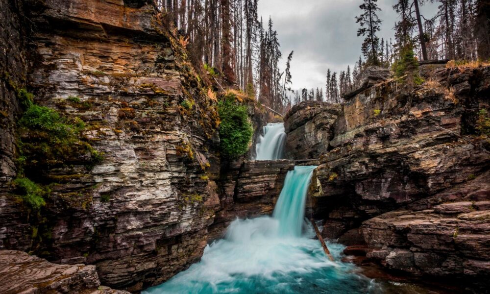

Quick answer (reviewed October 15, 2026): St. Mary Falls is a dramatic double waterfall with turquoise water in the St. Mary area of Glacier National Park, Montana, near Going-to-the-Sun Road. From the St. Mary Falls Shuttle Stop, it is approximately 0.8 mile one way (about 1.6 miles round trip); from the St. Mary Falls Trailhead parking area, the distance is approximately 1.2 miles one way (2.4 miles round trip). Both routes descend about 260 feet on the way to the falls, so expect an uphill return. Continuing to Virginia Falls makes a longer outing.
The most common trip-planning error is to quote a single distance without naming the starting point. Glacier National Park publishes several routes to St. Mary Falls, including an optional boat approach, and the scenic waterfall looks different depending on the season. Here are the correct distances, parking options, water hazards and autumn road-access cautions using National Park Service guidance.
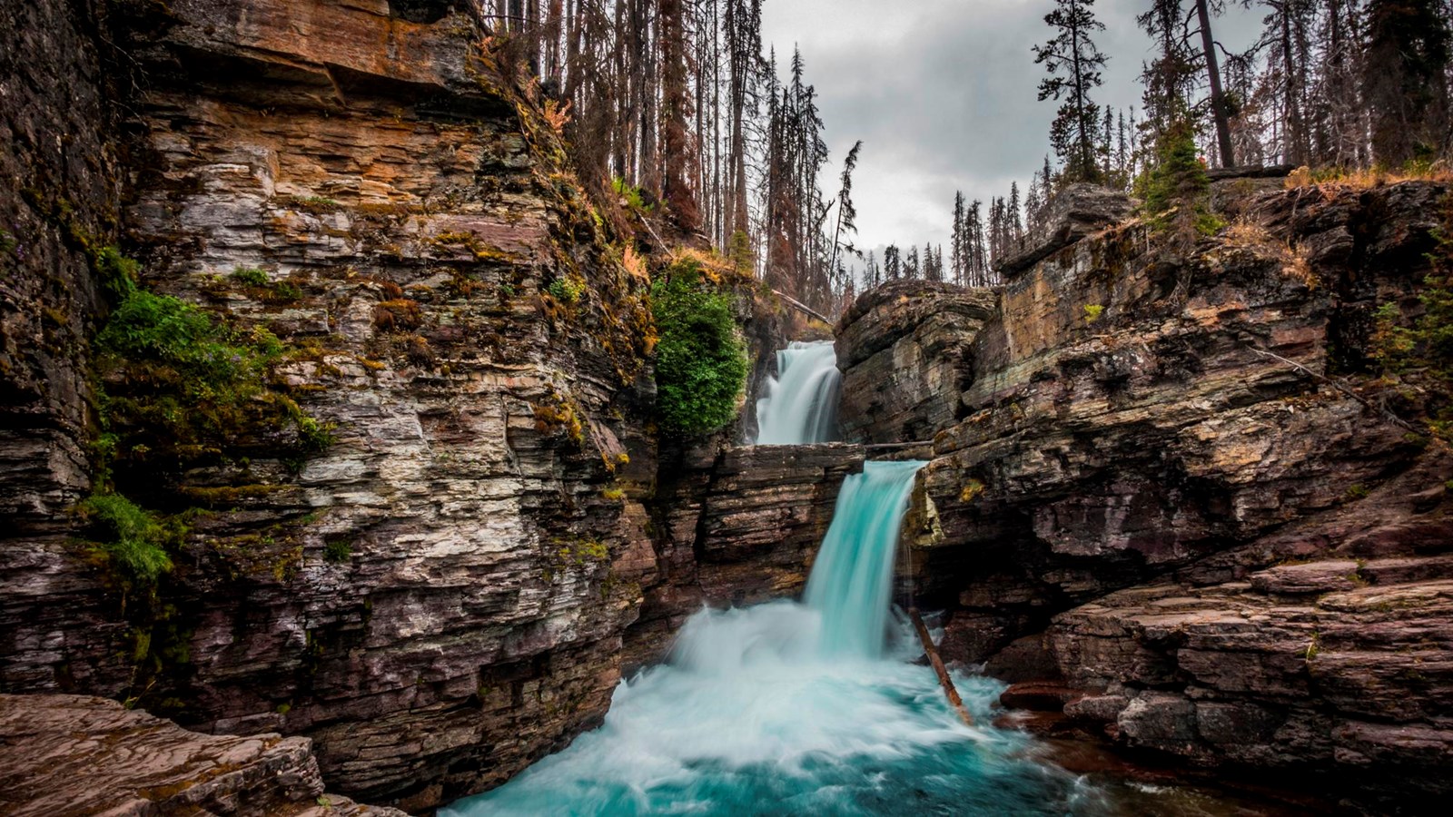
This is a genuine photograph of St. Mary Falls itself from National Park Service media, not a waterfall in Yellowstone or a generated depiction. It should not be interpreted as proof of live 2026 flow or trail conditions.
St. Mary Falls hike: official distances and trailheads
| Starting location | One-way distance to falls | Approximate round trip | Elevation change heading to waterfall |
|---|---|---|---|
| St. Mary Falls Shuttle Stop | 0.8 mile / 1.3 km | 1.6 miles / 2.6 km | 260 feet (79 m) downhill |
| St. Mary Falls Trailhead parking | 1.2 miles / 1.9 km | 2.4 miles / 3.8 km | 260 feet (79 m) downhill |
| Concession boat from Rising Sun | 1.6 miles / 2.5 km | 3.2 miles / 5 km | 140 feet (42.5 m) uphill |
| St. Mary Falls Trailhead to Virginia Falls | 1.8 miles / 2.9 km | 3.6 miles / 5.8 km | Varies along route; see NPS map |
These official distances are provided by NPS’s St. Mary Falls Trail page and its Hiking St. Mary guide. Some trip reports claim 1.5, 2.4 or 3.6 miles as if they describe the same experience. They do not: the exact route and whether you include Virginia Falls both change the total.
All stated mileages are trail distances rather than the driving distance from the St. Mary entrance station. Adding the drive from your lodging or a roadside walk from overflow parking will extend the overall trip.
Where is St. Mary Falls in Glacier National Park?
St. Mary Falls is on the park’s east side, in the St. Mary valley just above St. Mary Lake. The falls sit below sections of the famous Going-to-the-Sun Road. This location makes them attractive to visitors exploring the road from the St. Mary side, but it also means the trailheads and roadside shuttle stops are subject to seasonal road access.
St. Mary Falls features two steps of fast, brilliant blue-green water framed by rock and surviving trees. The surrounding forest experienced extensive fire activity in 2015, and NPS notes that the trail has relatively little shade in some places. Bring sun protection even when hiking toward a waterfall: the trail is not necessarily a cool, shady canyon walk from start to finish.
Which parking area should I use?
If you want to begin at the named St. Mary Falls Trailhead parking area, follow current park signs and maps for the trailhead along Going-to-the-Sun Road. The NPS trailhead description warns that parking is limited and fills quickly in busy months. If the lot is full, do not park illegally on a tight mountain-road shoulder. The park’s seasonal shuttle service may be an alternative when it is operating.
The St. Mary Falls Shuttle Stop route is shorter than the trailhead route, but availability depends on the shuttle schedule and the road’s seasonal operations. Verify transportation rather than assuming the summer shuttle runs during an October visit.
Can I reach the falls from the Rising Sun boat?
NPS lists an approach using a concession-operated boat from Rising Sun. After the boat ride, the trail segment to the waterfall is about 1.6 miles one way, with about 140 feet of gain. This is not a free public shuttle: tour fees, departures and seasonal availability are separate matters. Do not count on this route unless you have confirmed that a boat trip is running on your particular day.
What is the hike to St. Mary Falls like?
From the roadside trailhead or shuttle stop, you descend toward the water through an open and partially burned forest. The trail passes rocky and vegetated terrain before reaching the river and the falls. Because most of the net change is downhill on the approach, the effort often feels greater on the return.
- Choose the correct start: use the NPS map to distinguish the shuttle-stop route from the farther trailhead.
- Check access first: confirm Going-to-the-Sun Road status, parking, shuttle service and any temporary closures.
- Begin downhill: keep some energy for climbing approximately 260 feet back to the roadway.
- Approach the falls carefully: stay on maintained paths and observe wet rock or drop-off hazards.
- Enjoy the view from authorized viewpoints: the two-tier cascade is the main attraction, not a place to enter the stream.
- Choose your return: turn back for the shorter visit or continue toward Virginia Falls if conditions and daylight allow.
Is the hike easy for beginners?
The relatively short distance makes it approachable for many beginners who are comfortable with uneven natural surfaces and a modest uphill return. But the exposed forest and elevation change are more demanding on a hot day or for a visitor unused to walking. Children and slower hikers may need more frequent breaks. No amount of “easy hike” labeling replaces checking real trail, weather and mobility requirements.
How long will it take?
A modest round-trip hike to the falls can take an hour or two depending on the starting point and how much time you spend admiring the water. These are planning approximations rather than official guaranteed times. Add significant time if the parking lot is busy, you use a shuttle, or you continue to Virginia Falls.
St. Mary Falls vs Virginia Falls: which should you hike?
Both are popular waterfalls in the St. Mary area and can be visited during the same trip. But they are not the same location. St. Mary Falls is the blue-green double cascade reached first by the standard approach. Virginia Falls lies farther along the trail, giving visitors a taller and different waterfall setting.
| Feature | St. Mary Falls | Virginia Falls |
|---|---|---|
| Best short destination | Shorter waterfall outing from roadside route | Longer hike for visitors with more time |
| NPS one-way distance from St. Mary Falls Trailhead | 1.2 miles | 1.8 miles |
| What stands out | Two-step bright turquoise cascade | A separate, higher waterfall with additional forest walking |
| Parking | Roadside trailhead or shuttle stop depending on route | Shares the St. Mary Falls access area for the route described |
| Return effort | Moderate uphill after a downhill start | Longer total walk and variable grade |
NPS documents the route to Virginia Falls from the St. Mary Falls Trailhead as 1.8 miles one way. From that starting point, a complete Virginia Falls out-and-back is approximately 3.6 miles, not the same as the 2.4-mile St. Mary Falls-only version. Trail junctions and route extensions are easier to understand with the official Glacier map than with an unexplained “Virginia Falls distance” number.
Can you visit both in one morning?
Possibly, if the road and trail are open, parking or shuttle transport work smoothly, and your group can walk the longer distance safely. Leave flexibility for wildlife traffic and photography. In October, plan especially conservatively because daylight and services are reduced compared with high summer.
St. Mary Falls parking and Going-to-the-Sun Road access in 2026
Do not assume the full Going-to-the-Sun Road is open year-round. The alpine section is seasonal and can close due to snow, maintenance or hazardous conditions. Even if a park entrance or a town named St. Mary is accessible, that does not prove you can drive to the exact falls trailhead.
Before a 2026 visit, read the park’s current conditions and Going-to-the-Sun Road information. Seasonal shuttle operations, vehicle rules and access limitations can change. Any online itinerary saying “the road is definitely open today” without a live authoritative source should be treated cautiously.
Is there a reserved parking space for visitors?
No generic blog can guarantee a spot. NPS says the St. Mary Falls trailhead lot is limited and fills quickly in the busiest periods. Visitors should not block the roadside or enter signed restricted areas. If summer shuttle service is available, compare its stops and schedules to your starting location.
Can you hike in October?
October can be beautiful in Glacier, but snow and ice can arrive early and drastically change road or trail access. A trail that is simple in August can be unsafe or inaccessible in late fall. Check current Glacier advisories close to departure, not just seasonal averages. Avoid treating this article’s October 2026 review date as verification that a specific section of the road is open tonight.
Why is the water at St. Mary Falls so blue?
The waterfall is known for its striking blue-green appearance in sunlight. Glacial landscapes and cold, clear mountain water can produce vivid blue or turquoise colors through light absorption and scattering in natural conditions. The exact shade in any photograph also depends on illumination, sky, surrounding rocks, water clarity and camera processing.
It would be misleading to guarantee that the falls look fluorescent turquoise every hour of every season. Overcast weather, shadows, changing sediment loads and photo-editing decisions can alter the displayed color. The actual waterfall remains striking even when the water appears less saturated than in a long-exposure or professionally edited travel photograph.
How does the burned forest affect the hike?
According to NPS, the forest along the route was affected by fires in 2015. Burned areas may offer open views and young regrowth, but they also have reduced shade and potential hazards such as unstable dead trees. Stay on the established route and avoid lingering beneath visibly damaged trees in strong wind.
Safety: strong water, slippery rocks and wildlife
St. Mary Falls is a fast-flowing cascade in rocky terrain, not a designated swimming spot. Never climb out onto rock ledges, leap from the bridge or approach hazardous currents for a photograph. NPS emphasizes extra caution near water, steep drop-offs and wildlife. Past fatalities near fast-moving Glacier waterfalls are reminders that a beautiful pool can be extremely dangerous even on a warm afternoon.
Use maintained viewpoints and any bridge as intended. In the event of storms, lightning, ice or high water, change your plans rather than forcing a hike to meet a schedule. Bring a map and tell someone your intended route; cell service can be unreliable in a national park.
What should you do if you see a bear?
Glacier is bear country. Follow the park’s official bear-safety advice, carry bear spray where allowed and know how to use it, make noise where visibility is limited, and give all wildlife abundant space. Never approach animals for a photograph or leave food where wildlife can access it.
What shoes should you wear?
Choose supportive shoes with dependable traction on uneven trail sections. Wet rocks are slippery and conditions change quickly. If you plan to continue to Virginia Falls or hike after rain, lightweight trail shoes or hiking boots are preferable to smooth-soled sandals.
How St. Mary Falls compares with other national-park waterfalls
Each waterfall destination has distinct road and safety requirements. St. Mary Falls is a short but exposed hike in Montana, whereas our Multnomah Falls guide in Oregon covers a different tourist-access waterfall with separate timed permit and trail considerations. For broad riverside overlook options in Virginia, see our Great Falls Park guide. These are comparisons, not alternative trailheads to Glacier’s waterfall.
The common lesson is to check a park’s own instructions first. Similar waterfall names, distance claims and parking tips from another destination are not interchangeable with the exact route to St. Mary Falls.
What to bring for the St. Mary Falls trail
- Water and snacks: plan for an exposed, uphill return, and more supplies if extending to Virginia Falls.
- Reliable traction: wet or icy rock near waterfalls is a hazard.
- Sun protection: the burned forest provides less shade than some shaded canyon trails.
- A warm layer: the valley can be cool even when sunshine feels strong.
- Downloaded map: make sure you know which trailhead or shuttle stop is your return point.
- Wildlife precautions: read Glacier’s bear guidance and keep food secured.
- Road-status check: confirm your vehicle or seasonal shuttle can access the chosen starting point.
Frequently asked questions about St. Mary Falls
How long is the St. Mary Falls hike?
About 1.6 miles round trip from the St. Mary Falls Shuttle Stop or 2.4 miles round trip from the St. Mary Falls Trailhead, according to NPS.
Is St. Mary Falls in Montana?
Yes. It is in Glacier National Park, Montana, near St. Mary Lake and Going-to-the-Sun Road.
Can I see St. Mary Falls without hiking?
The maintained waterfall viewpoints normally require walking from a trailhead, shuttle stop or boat-linked route. It is not a simple parking-lot-only roadside overlook.
Is the route entirely downhill?
The NPS documents a net descent of about 260 feet heading toward the falls from the shuttle stop or named trailhead. On an out-and-back walk, you generally regain that elevation on the way to your starting point.
How do I add Virginia Falls?
Continue along the maintained trail beyond St. Mary Falls following official signs. From the named St. Mary Falls Trailhead, NPS lists Virginia Falls as approximately 1.8 miles one way, about 3.6 miles for the complete out-and-back.
Does the summer shuttle run in October?
Do not assume so. Seasonal shuttle service and Going-to-the-Sun Road access vary. Check Glacier’s current official shuttle calendar before relying on a shuttle-stop start.
Can I swim at St. Mary Falls?
Never treat the turbulent waterfall as a swimming spot. Water around drops and bridges can be cold, fast and dangerously unpredictable.
Is the St. Mary Falls Trailhead easy to park at?
The parking lot is limited and fills quickly during busy periods, according to NPS. Use current parking guidance and avoid blocking road shoulders.
Official sources and verification
- NPS: St. Mary Falls Trail — one-way distance and elevation for three approaches, including Virginia Falls.
- NPS: Hiking St. Mary — official trail and regional route listings.
- NPS: St. Mary Falls Trailhead — parking, shuttle and amenities.
- NPS: Glacier Conditions — current seasonal road and trail changes.
- NPS: Bear Safety — safe hiking behavior in bear habitat.
Editorial review date October 15, 2026. This article does not imply that AVARIXO hiked or live-tested the trail, that a shuttle is operating in October, or that a seasonal mountain road is currently open. Waterfall photography is an authentic NPS image, not generated proof of a new event.