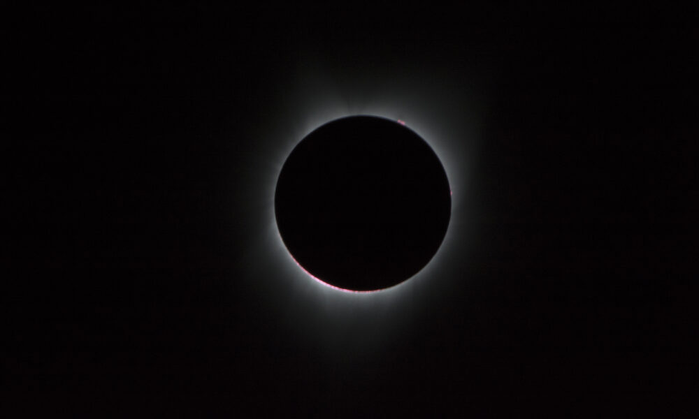

Quick answer: On August 21, 2017, a total solar eclipse crossed the contiguous United States from the Oregon coast to South Carolina. It became widely known as the Great American Eclipse because millions could reach the narrow path of totality, where the Moon completely covered the Sun and its faint corona became visible. People outside the path across much of North America saw a partial eclipse instead. Totality at any one location lasted at most about 2 minutes 40 seconds, not the full ninety minutes it took the Moon’s shadow to cross the country.
2017 total solar eclipse: key facts
| Question | Verified answer |
|---|---|
| Date | Monday, August 21, 2017 |
| Type | Total solar eclipse |
| Path across United States | From Oregon to South Carolina |
| Duration of totality | Up to roughly 2 minutes 40 seconds near the center of the path |
| Partial eclipse visibility | Most of North America and parts of nearby regions |
| Cause | The Moon passed between Earth and Sun, blocking the solar disk for viewers in the umbra |
| Safety | Special-purpose solar viewers for partial phases; unaided viewing only during actual totality |
| Photographs | NASA captured the event from aircraft and ground locations |
NASA’s official eclipse-path calculations provide the track and local times, while the NASA eclipse archive explains where it was visible.
What made the 2017 eclipse special?
Total solar eclipses happen somewhere on Earth relatively frequently, but many cross oceans or remote terrain. This event ran across the United States during summer, making observation practical for an enormous audience. Totality could be watched from numerous communities along its path, though cloud cover still affected visibility. It was the first total eclipse visible across a substantial portion of the contiguous U.S. since 1979 and the first coast-to-coast U.S. totality path in 99 years.
What is the path of totality?
The Moon casts two main types of shadow. The narrow, darker umbra creates a total eclipse when it reaches Earth’s surface, while the much larger penumbra creates a partial eclipse. An observer just outside the path of totality—even one who sees 99% of the Sun covered—does not experience the true dark sky and exposed solar corona of totality. This explains why accurate location mattered so much to travelers in 2017.
Where did the eclipse cross the United States?
It first reached land near the Oregon coast, then continued southeast across states including Idaho, Wyoming, Nebraska, Missouri, Kentucky, Tennessee and South Carolina. Parts of additional states touched the path, so counting “states with totality” requires a consistent method for including narrow boundary crossings. NASA’s Science Visualization Studio notes that the umbra’s path grazed small parts of Montana and Iowa as well as better-known central-route states.
The shadow moved across the lower 48 in approximately 90 minutes, but each town experienced only a brief period of totality. The NASA eclipse 2017 visualization gallery contains historical maps and shadow animations derived from orbital geometry. These illustrations are maps, not photographs of the eclipse.
What could people see during totality?
As the Moon covered the last exposed edge of the Sun, observers inside the path saw the sky darken and bright stars or planets become easier to spot. A fine crown of light called the solar corona became visible around the black lunar disk. Before and after totality, brief bright points near the edge could form Baily’s beads and the diamond-ring effect.
Why does the corona look like white streamers?
The corona is the hot outer atmosphere of the Sun. Its glowing structures follow magnetic fields, and their shapes can vary with solar activity. The corona is not produced by the Moon: the Moon’s blocking of the brighter solar surface merely allows a human observer to see it.
NASA’s real photographs of the 2017 eclipse
NASA photographed the eclipse from ground locations and research aircraft. An Armstrong Flight Research Center team captured images from a Gulfstream III aircraft roughly 25,000 feet above the Oregon coast; the aircraft’s altitude helped place the cameras above some lower cloud layers. The image associated with this article comes from NASA’s authentic August 21, 2017 eclipse coverage, not a render of a future eclipse or an unlicensed stock scene.
NASA’s August 2017 image record and eclipse gallery let readers compare true photographs with diagram-style visualizations.
Total solar eclipse versus partial solar eclipse
| Experience | Totality within umbra | Partial phase |
|---|---|---|
| Moon’s coverage | Entire bright solar disk | Only part of bright disk |
| Solar corona | Directly visible if conditions permit | Not safely visible unaided |
| Protective eyewear | May be removed only during complete totality | Required throughout direct viewing |
| Sky brightness | Can resemble deep twilight | Often appears surprisingly bright |
Why eclipse eye safety matters
Never look directly at the uneclipsed or partly eclipsed Sun through ordinary sunglasses, an unfiltered camera lens, binoculars or a telescope. Proper solar filters are required for direct observation during partial phases. Special-purpose eclipse glasses or handheld viewers must meet appropriate international solar-viewer standards and be undamaged. Outside the path of totality, there is no safe interval for naked-eye solar viewing. Inside the path, observers should follow NASA’s precise guidance for the short period when the bright solar surface is fully blocked.
Was the 2017 eclipse the same as the April 2024 eclipse?
No. They were separate solar eclipses seven years apart, with different paths and durations. The April 8, 2024 total eclipse crossed Mexico, the United States and Canada on a southwest-to-northeast track. Photos taken in 2024 should not be labeled as “the 2017 eclipse,” even though both show a black lunar disk and shining corona.
How to investigate the original event today
- Open NASA’s 2017 path table to select a location along the historical route.
- Check whether that location was inside the umbra or only the partial-eclipse region.
- Compare the location’s published totality duration with the maximum near the path center.
- View an original NASA 2017 photograph and confirm its photo ID, date and camera location.
- Distinguish actual imagery from animated path visualizations before citing it.
Frequently asked questions
What date was the Great American Eclipse?
August 21, 2017.
How long did the 2017 eclipse last?
The Moon’s shadow crossed the U.S. in about 90 minutes, but totality lasted at most roughly 2 minutes 40 seconds at a specific observing site.
Was the eclipse visible across the entire U.S.?
Most places saw a partial eclipse. Only observers within the narrow path of totality saw full solar coverage.
What was the first state to see totality?
Oregon was the first state on the main coast-to-coast land crossing.
Did NASA create photographs or only computer simulations?
Both. NASA teams captured actual images and published scientific path animations. Their different origins should be identified accurately.
Historical fact review: October 2026. Official sources: NASA Eclipse 2017, NASA eclipse-path calculations, NASA SVS eclipse gallery.

Other Articles