
Quick answer — updated October 15, 2026: The Vernal Fall Footbridge hike in Yosemite National Park is a 1.6-mile (2.6-km) round trip from the Happy Isles trailhead, with about 400 feet (120 m) of elevation gain. The National Park Service rates the walk moderate and estimates 1 to 1.5 hours. Begin at Happy Isles, shuttle stop 16, follow the first paved, uphill section of the Mist Trail corridor, and return from the footbridge for a view of the 317-foot Vernal Fall. Going all the way to the top of Vernal Fall is a different, longer and more strenuous hike.
Yosemite’s 2026 Mist Trail repair work is especially important if you plan to continue beyond the footbridge. NPS lists a weekday daytime detour for part of the route between late July and October, subject to change. The footbridge turnaround is below that repair area, but changes in weather or park alerts may still affect access. Always check the official Vernal and Nevada Fall trail advisory on the day you go.
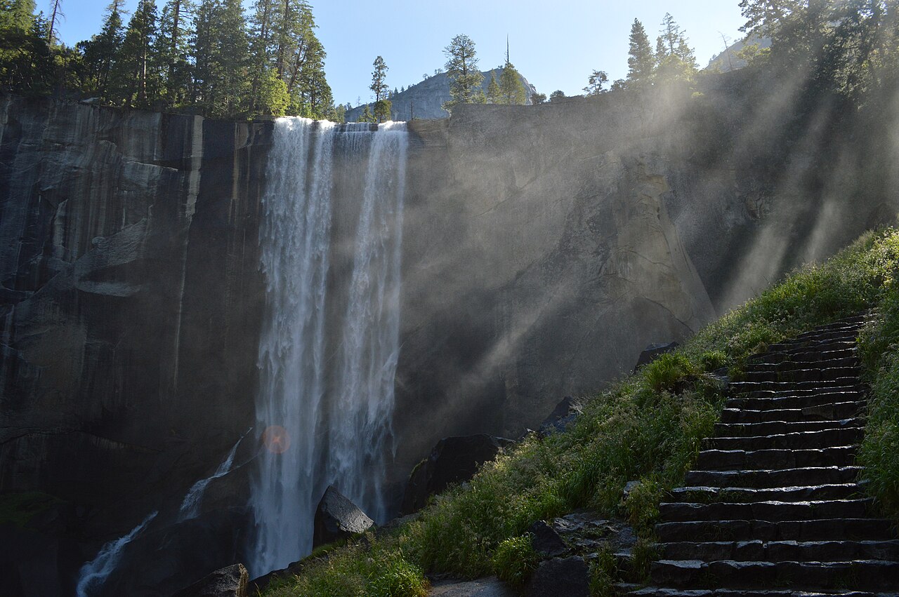
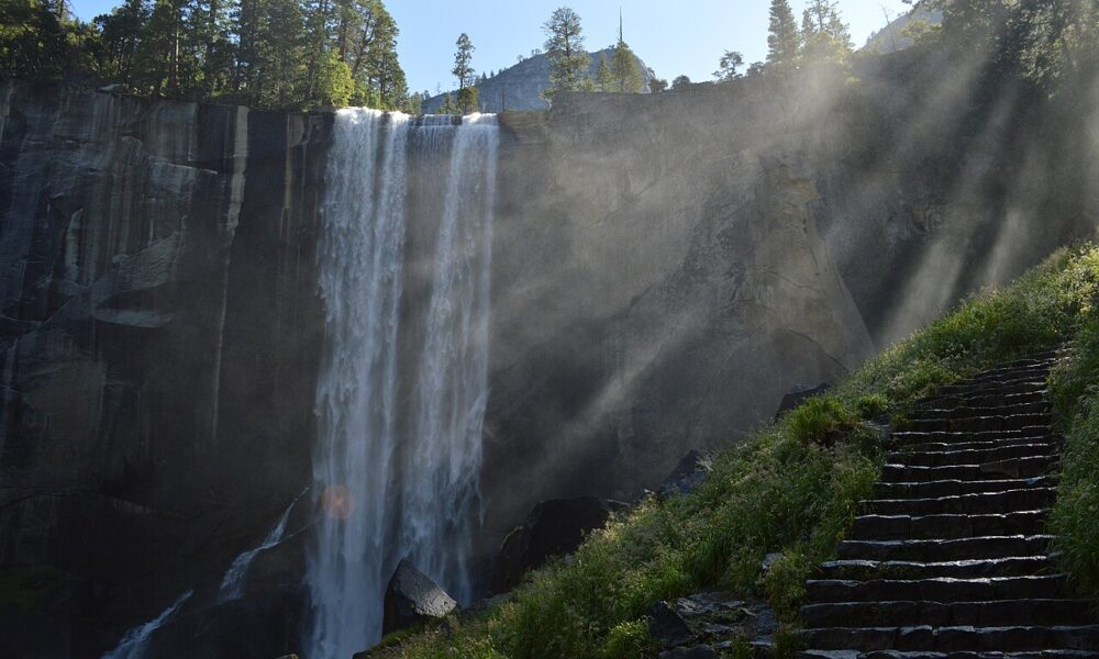
The image above is an authentic photograph of Vernal Fall itself, taken in 2015, not a staged or AI-generated view. It does not claim to document the exact appearance of the footbridge or the amount of waterfall flow in October 2026.
Vernal Fall Footbridge trail facts
| Question | Official answer | Practical meaning |
|---|---|---|
| Where to start | Happy Isles, shuttle stop 16 | This is in the eastern end of Yosemite Valley |
| Distance to footbridge | 0.8 mile / 1.3 km one way | 1.6 miles total if you return on the same route |
| Elevation gain | 400 feet / 120 m | The outward section is mostly uphill |
| Official difficulty | Moderate | Short but steep for some visitors |
| Time estimate | 1–1.5 hours | Allow extra time for photos, water and breaks |
| Footbridge view | Vernal Fall, about 317 feet tall | You see the fall from below, not from its brink |
| Parking | No parking at trailhead | Park in Yosemite Valley and walk or use a shuttle |
| Drinking water | At footbridge seasonally, May–October | Never rely on it without checking availability |
| Pets/bikes/strollers | Not permitted | Paved trail does not equal stroller-friendly permission |
These details come from the National Park Service route descriptions and Mist and John Muir Trailhead guidance. Distance estimates assume the hike begins at Happy Isles. Walking to that trailhead from a separate parking location increases your actual day’s mileage.
Where is the Vernal Fall Footbridge?
The footbridge crosses the Merced River within the Yosemite Valley hiking corridor that also leads to the top of Vernal Fall and, farther uphill, Nevada Fall. The route starts near Happy Isles. It is not in Hetch Hetchy, Wawona or along the separate Yosemite Falls trail.
From Happy Isles, follow signs for the Vernal Fall Footbridge / Mist Trail. The first segment is paved but climbs steadily. NPS says an excellent view of Vernal Fall opens up at the bridge, approximately 0.8 mile from the trailhead. This is a natural turnaround for hikers who want to see the cascade without climbing the steep, often wet granite steps above it.
Is the bridge the same as the top of Vernal Fall?
No. The footbridge is a viewing point below Vernal Fall. Reaching the top requires extra elevation and a longer route. The official short option is 1.6 miles round trip, 400 feet of climb. The longer route to the waterfall’s top is about 2.4 miles round trip with 1,000 feet of gain when the regular Mist Trail route is open.
Is it the same bridge at Nevada Fall?
No. There is also a footbridge above Nevada Fall, but it is much farther up the mountain. If your goal is only the easy-to-plan Vernal Fall overlook, do not accidentally follow instructions for the Nevada Fall loop or Half Dome route.
How to hike from Happy Isles to the footbridge
- Reach Happy Isles: take the relevant Yosemite Valley shuttle to stop 16 when service is running, or walk from an authorized parking area. Check the shuttle map and schedule first.
- Find the trail signs: cross the bridge near the trailhead and follow the paved route toward Vernal Fall, not an unrelated valley trail.
- Climb the first paved section: the trail gains about 400 feet in less than one mile. Pace yourself and pause where you can safely step aside for others.
- Arrive at the Vernal Fall Footbridge: look upstream for views of the waterfall and the rocky Merced River corridor. The bridge is a viewpoint, not an invitation to enter the water.
- Choose your turnaround: for the basic 1.6-mile option, return downhill along the same route.
- If considering the upper falls: continue only after checking seasonal Mist Trail detours, weather, footwear, daylight and your group’s ability to climb steep steps.
The walking route is out and back if you stop at the footbridge. A different path, loop or detour should never be described using the short 1.6-mile figure.
Why is a paved 0.8-mile walk considered moderate?
Because the trail climbs substantially in a short distance. The surface is relatively smooth at the beginning, but the sustained grade can challenge visitors accustomed to flat walking. Yosemite’s altitude, heat on sunny days and crowded sections also affect effort. The route is not automatically accessible simply because it begins on pavement.
Can children complete the footbridge hike?
Some families enjoy this outing, but the answer depends on each child’s stamina, conditions and supervision. Children should be kept well away from edges and fast water. The park prohibits strollers on this trail, so plan to walk at a comfortable pace and be prepared to turn around before the bridge if needed.
How long will the hike actually take?
NPS gives 1 to 1.5 hours for the standard round trip. That is a useful baseline, not a promise. Allow extra time to reach Happy Isles from your parking space, wait for a shuttle, take photographs and return safely. Avoid planning a tight connection with another reservation.
Parking and shuttles: what to know before starting
There is no trailhead parking at Happy Isles itself. The official guidance points visitors toward Yosemite Valley parking, including Curry Village, less than one mile from the trailhead. That additional walk may matter more than expected for a group measuring how far it can comfortably hike.
When Yosemite’s Valleywide or East Valley shuttle is in service, use the route that serves Happy Isles (stop 16). Shuttle frequency and operations may change with season and construction, so check the current park page. Do not assume that finding “Vernal Fall” on a navigation app means you can drive to the bridge.
Where should I park if Curry Village is full?
Use other authorized Yosemite Valley day-use parking areas and park transportation as directed by the NPS. Never park across closed lanes or block bus stops. Parking crowds and road restrictions can change daily; an itinerary should account for a potentially longer approach to Happy Isles.
Is a reservation required for the hike?
The footbridge is a standard day-hiking destination, not a separate ticketed waterfall attraction. However, Yosemite’s park entry and reservation requirements may change by year and travel date. Read the official Yosemite fees and passes page and current park entry advisories. Do not confuse a potential timed entrance reservation with a required reservation for the footbridge itself.
2026 Mist Trail detour: does it affect the footbridge?
As of NPS’s July 27, 2026 update, the section from the lower John Muir Trail junction above the Vernal Fall footbridge toward the top of Vernal Fall has repair restrictions during parts of the week. From late July through October (subject to change), it is typically open on weekends and holidays, and outside specified daytime repair hours on weekdays when safe. NPS identifies the John Muir Trail as the alternate route during restricted periods.
The key distinction: that repair section begins above the footbridge. If your destination is only the 0.8-mile footbridge viewpoint, the regularly described detour is farther along than your turnaround. Nevertheless, other temporary closures, weather and safety conditions can still affect the area. Confirm live park conditions before relying on any static 2026 guide.
Can I continue to the top of Vernal Fall during the detour?
Sometimes, but not always by the usual direct staircase. Follow on-site NPS signs toward the John Muir Trail alternate route when the affected Mist Trail segment is closed. Distances and timing may differ from the normal 2.4-mile out-and-back estimate. Never go around construction barriers or rely on an older map that shows no detour.
What changes in winter?
The park warns that some portions of the Mist Trail and John Muir Trail close during winter because of ice, falling rock and hazardous conditions. An officially signed winter route may remain open, but conditions can be strenuous. A short summer hike should not be presented as identical to the winter experience.
Footbridge vs top of Vernal Fall vs Nevada Fall
| Destination from Happy Isles | NPS round trip | Elevation gain | Typical time |
|---|---|---|---|
| Vernal Fall Footbridge | 1.6 miles / 2.6 km | 400 feet / 120 m | 1–1.5 hours |
| Top of Vernal Fall, via regular Mist Trail | 2.4 miles / 3.9 km | 1,000 feet / 300 m | About 3 hours |
| Top of Nevada Fall, via regular Mist Trail | 5.4 miles / 8.7 km | 2,000 feet / 610 m | 5–6 hours |
These are normal-condition NPS route estimates, not guaranteed times or route lengths when a detour is active. The biggest jump in effort is beyond the bridge: the Mist Trail climbs over 600 steep granite steps above the lower junction to the top of Vernal Fall.
If you want more waterfall sightseeing without a strenuous climb, the footbridge is the natural choice. If you are fit and prepared for wet, steep rock, the longer Mist Trail can provide a much closer view of the waterfall. Nevada Fall is a more substantial hike and should not be treated as an effortless extension of a footbridge visit.
When is the best time to see Vernal Fall?
The waterfall generally runs throughout the year, but its volume changes sharply with mountain snowmelt and rainfall. Spring and early summer tend to bring stronger water and heavier mist; by fall, flow can shrink dramatically even while the falls remain visible. For October visitors, expect conditions and water volume that may differ from spring photographs.
| Season | What you may experience | Main concern |
|---|---|---|
| Spring | High flow, dramatic spray, sometimes rainbows | Wet or slippery surfaces and very powerful river current |
| Summer | Popular footbridge hike with long daylight | Heat, crowds and higher water use |
| Autumn | Often quieter and with less waterfall flow | Detours, fewer services and variable weather |
| Winter | Scenic ice and low-season landscape | Hazardous ice and seasonally closed trail sections |
The NPS fall visitor guide specifically notes that Vernal and Nevada Falls flow year-round but can slow to a trickle in fall. The waterfall photograph on this page is a historical photograph from 2015 and should not be used as evidence of October 2026 water levels.
Is the waterfall visible from the footbridge in low flow?
The footbridge is an established viewpoint of Vernal Fall, but the waterfall’s apparent size and intensity depend on the amount of water present, weather and visibility. If you want dramatic spray for photography, spring generally offers stronger flow than October; choose the season based on the kind of scene you hope to see.
What is the best time of day?
There is no guaranteed universal “perfect” hour for a view. Morning or later in the day may offer different shadows and crowds depending on season, while mist and rainbows vary with sun position and water volume. Plan around safe daylight, current weather and shuttle operations rather than an unverified social-media schedule.
Safety rules at Vernal Fall Footbridge
Yosemite warns against swimming, wading or entering the river anywhere along this waterfall corridor. The river’s current and slippery rock can be fatal, even in shallow-looking water. Stay on the designated path, respect railings, and never attempt to climb onto the rocks below or above the falls for a photograph.
- Stay out of the Merced River. Smooth-looking pools can be connected to extremely powerful currents above steep drops.
- Respect trail repairs and detours. Construction closures are not optional suggestions.
- Carry drinking water. The footbridge supply is seasonal and cannot be assumed available in every month.
- Watch the return time. Daylight, shuttle service and walking pace may change your plan.
- Wear dependable shoes. The first route is paved, but steeper upper sections can be wet, loose and slippery.
- Keep children close. Do not let them climb barriers or approach steep river banks.
Are dogs and bicycles allowed?
No. The NPS explicitly lists pets, bicycles and strollers as prohibited on the Vernal and Nevada Fall routes. This applies even to the initial paved stretch. Plan a different permitted Yosemite walk if you are traveling with a pet.
Is water available at the footbridge?
Seasonally, yes. NPS reports drinking water at the footbridge from May to October, alongside restrooms available during those months. Availability may change because of maintenance or weather, and you should bring your own sufficient water instead of relying on a fountain.
What to bring for the short footbridge hike
A short trip still benefits from good planning: carry at least the water quantity recommended by the park for your route, weather-appropriate clothing, a small snack, sun protection and a park trail map. Bring a light layer in cooler months and a headlamp if there is any chance of finishing later than planned. If you intend to continue above the bridge, bring more supplies because the climb becomes substantially harder.
Do not treat the footbridge as a family picnic swimming spot or a place to leave litter. Keep food secured and within reach; Yosemite wildlife is accustomed to visitors and should never be fed.
Common mistakes when planning this hike
- Confusing a one-way figure with the total. The footbridge is 0.8 mile one way, or 1.6 miles round trip from Happy Isles.
- Using the top-of-fall elevation gain. The footbridge route climbs 400 feet, not the 1,000 feet required for the summit option.
- Assuming parking is at the trailhead. Plan to walk or use the appropriate valley shuttle.
- Ignoring the 2026 detour. It matters if you continue above the bridge.
- Expecting peak spring flow in October. Autumn generally brings a lower waterfall flow.
- Assuming a paved route permits strollers. NPS specifically prohibits them on this route.
Frequently asked questions
How many miles is the Vernal Fall Footbridge hike?
Approximately 1.6 miles round trip from Happy Isles, according to the National Park Service. That is 0.8 mile each way and gains about 400 feet.
Is the footbridge hike difficult?
It is rated moderate by NPS due to sustained climbing, although the initial path is paved. Visitors with mobility limitations should assess the slope before setting out.
Can I drive to Vernal Fall Footbridge?
No. There is no parking at the Happy Isles trailhead itself; use authorized Yosemite Valley parking and a shuttle or approach walk.
Is the footbridge open during 2026 Mist Trail repairs?
The listed repair restriction generally concerns the segment above the footbridge. However, conditions may change, and only current NPS alerts and on-site signs can confirm whether an individual trail segment is accessible when you visit.
Can I see Vernal Fall without going to the top?
Yes. The footbridge is an official viewpoint approximately 0.8 mile from Happy Isles. You do not need to climb the steep staircase to see the waterfall.
Are restrooms available?
NPS lists restrooms near Happy Isles and seasonal facilities at the footbridge, generally May through October. Check current park information for maintenance or seasonal closures.
Are swimming and wading allowed at the bridge?
No. Yosemite explicitly warns visitors not to enter the river along this corridor because of hazardous currents and waterfall drops.
Is this the same trail as Half Dome?
The routes share parts of the general trail corridor, but the footbridge walk is much shorter and does not reach Half Dome. Do not use Half Dome hike mileage or permit rules for the standard footbridge turnaround.
Official sources and related reading
- NPS Vernal Fall and Nevada Fall Trails — distances, safety, facilities, fall height and 2026 repairs.
- NPS Mist and John Muir Trailhead — Happy Isles start and detour information.
- NPS Yosemite Current Conditions — check live trail accessibility before departure.
- NPS Visiting in Fall — lower autumn waterfall flows.
For a different waterfall hiking experience, see our Dark Hollow Falls Trail guide in Shenandoah National Park. It is in Virginia, not Yosemite; parking and trail policies are different. This comparison is intended to help hikers understand why each national park requires its own route check.
Editorial review: October 15, 2026. This article does not claim the trail or shuttle was personally tested. Mist Trail repairs and seasonal facilities may change. Photograph: a real image of Vernal Fall from 2015, used under a CC0 public-domain dedication, not a live 2026 image.