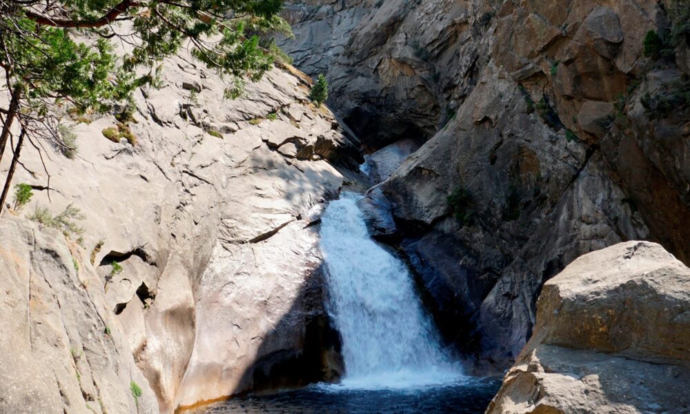

Quick answer (reviewed October 17, 2026): If you are searching for a King Canyon waterfall or the best Kings Canyon waterfalls, start with three very different stops in California’s Kings Canyon corridor: Roaring River Falls is a powerful 40-foot waterfall reached by a short paved trail near Cedar Grove, Grizzly Falls is an 80-foot cascade reached by a brief walk from Highway 180 in neighboring Sequoia National Forest, and Mist Falls is a substantial 8-mile round-trip hike starting from Road’s End inside Kings Canyon National Park. The right choice depends much more on your available time, parking and road conditions than on which photo looks most dramatic.
One road rule matters to all three: Highway 180 down into Cedar Grove is seasonal. The National Park Service says the section beyond Hume Lake Road typically closes in early to mid-November and reopens around late April or early May. As of the park’s October 13, 2026 conditions update, Cedar Grove trails were listed open, but autumn storms can change access at short notice. This guide explains which waterfall is actually inside the national park, which is in the adjacent forest, the true hiking distances and how to avoid unsafe swimming areas.
Which Kings Canyon waterfall should you visit?
The main decision is between a short roadside viewpoint and a longer hiking commitment. If you are comparing Kings Canyon with other California waterfall trips, see our Wapama Falls guide in Yosemite’s Hetch Hetchy area and the Chilnualna Falls hiking guide in Wawona; both are separate destinations with different access rules. For families, casual road trippers and visitors who want to see a dramatic waterfall with minimal walking, Roaring River Falls is the clearest first recommendation. Grizzly Falls is another quick stop along the scenic highway. Mist Falls is a real half-day hike with a much more demanding return than a photo-stop itinerary.
| Waterfall | Where it is | Walking effort | Best reason to visit |
|---|---|---|---|
| Roaring River Falls | Cedar Grove, Kings Canyon National Park | About 0.4 mile round trip in the NPS 2026 trip planner; paved but sloping | Fastest park waterfall stop with a strong granite-chute view |
| Grizzly Falls | Sequoia National Forest, beside the Kings Canyon Scenic Byway | About a five-minute walk from picnic-area parking | 80-foot cascade beside a convenient rest stop |
| Mist Falls | From Road’s End trailhead, Kings Canyon National Park | About 8 miles round trip; 4–5 hours; steeper final mile | Longer hike along the Kings River to a major waterfall |
These are three distinct destinations, not multiple names for the same waterfall. Their distances come from National Park Service Cedar Grove trail descriptions, the 2026 park trip planner and the official Grizzly Falls place guide.
1. Roaring River Falls: the easiest major waterfall stop
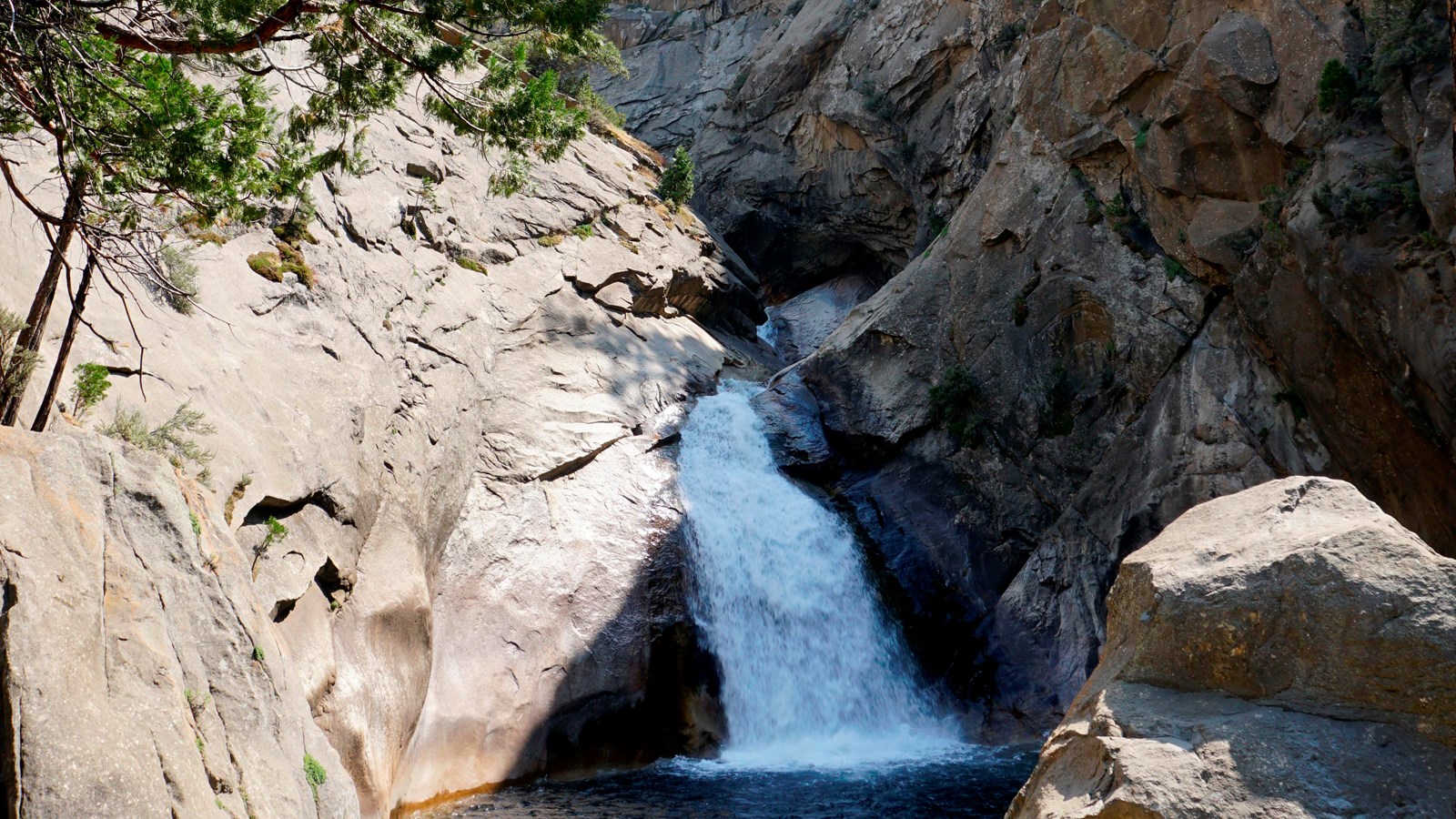
Roaring River Falls channels water from the mountainous Deadman and Cloud canyons through a narrow granite opening. Instead of a tall waterfall seen far away, visitors come relatively close to the 40-foot chute and the loud pool below it. The force of the water is especially noticeable in late spring and early summer, when the runoff is usually strongest.
How far is the walk to Roaring River Falls?
The National Park Service’s 2026 visitor trip planner lists a 0.4-mile trail for the visit, used here as a short round-trip planning estimate. More detailed NPS accessibility materials describe a 0.10-mile sloped approach to the view from a designated parking area. Other descriptions measure from different starting points or include the whole developed walkway. These figures are not a license to promise every visitor an identical GPS distance: the practical takeaway is that this is a short walk, not a backcountry hike.
From the Cedar Grove area, continue east on Highway 180 about 3 miles from Cedar Grove Village to the signed Roaring River Falls parking area. When the limited parking spaces are full, the park identifies overflow parking across the bridge a short distance away. Use designated parking only; do not stop in a moving traffic lane for a photograph.
Is Roaring River Falls wheelchair accessible?
The park lists an accessible parking space and a paved route to the lookout, but paved does not mean level. The NPS accessibility guide records portions around 10–12% grade, more demanding than many visitors expect. Surface and slope can affect independent wheelchair access; consult the NPS Cedar Grove accessibility guide and current conditions for specific mobility needs.
Can you swim in the waterfall pool?
Do not swim at Roaring River Falls. NPS explicitly warns that the water below the apparently calm surface contains currents strong enough to pull people under, and slippery rocks make the pool even more dangerous. Stay at the established viewpoint rather than climbing over barriers or jumping toward the water for a better picture. The park emphasizes that river drowning is a major cause of death in Sequoia and Kings Canyon.
For precise trailhead information, check Roaring River Falls Trailhead (NPS) and the official waterfall place page.
2. Grizzly Falls: a quick stop in Sequoia National Forest
Grizzly Falls is an approximately 80-foot waterfall reached by a short walk from a picnic area beside the Kings Canyon Scenic Byway (Highway 180). It is frequently included in Kings Canyon sightseeing itineraries, but the land is managed as Sequoia National Forest, not the national park proper. That distinction matters because park and national forest regulations may differ, including some recreation and pet rules.
The official NPS information places Grizzly Falls approximately 4.6 miles west of Cedar Grove Visitor Center. It has a picnic area, restrooms and trash facilities, but the park’s listing says there are no grills or drinking-water facilities at this spot. Do not assume a waterfall near a highway provides treated water or a place to buy supplies.
How long does the Grizzly Falls walk take?
The park’s summer scenic-drive guidance describes an easy five-minute walk from the picnic area to the waterfall. This is useful for visitors with little hiking time. In practice, travel time, parking and the number of photographs you take are separate from the walking time itself.
Is Grizzly Falls part of Kings Canyon National Park?
No. It is on the national forest section of the same scenic highway. The NPS’s Grizzly Falls page explicitly identifies the site as Sequoia National Forest. The highway passes through multiple jurisdictions, so follow posted signs and the appropriate land manager’s rules.
When does Grizzly Falls look its best?
The official NPS page notes stronger water in the spring. The view can be attractive in summer and fall, but water volume changes through the seasons. A photograph taken during spring runoff should not be used to predict exactly how powerful the cascade will look during an October visit.
3. Mist Falls: the full Kings Canyon waterfall hike
If you want a substantial walk and not just a pullout stop, Mist Falls is the option that most clearly changes the day’s schedule. NPS describes an 8-mile round-trip route, normally taking 4–5 hours. The first section follows the glaciated South Fork Kings River corridor through forest and chaparral; the final approach includes a 600-foot climb during the last mile to the falls.
Begin at Road’s End, the eastern end of the scenic highway in Cedar Grove. Find the designated trailhead just past the Road’s End permit station. It is not the same parking place used for Roaring River Falls, and walking there from the shorter waterfall pullout would change the hiking distance significantly.
Why do some websites list 9 miles instead of 8?
Older visitor materials and different guidebooks can quote different totals or turnaround points. Current NPS Cedar Grove trail descriptions give 8 miles round trip, and the park’s separate Rae Lakes mileage chart locates Mist Falls at approximately 3.9 miles from Road’s End. Twice that is around 7.8 miles before minor trailhead and turnaround variation. Use the published NPS figure for general planning and let the current trail map determine your exact turnaround.
Is Mist Falls a beginner-friendly hike?
An eight-mile outing with rocky surfaces and a steeper final approach is best for visitors prepared for a moderate-to-strenuous half-day walk, depending on fitness, heat and trail condition. Canyon temperatures can be hot, and the first flat miles can give an impression of ease before the climb begins. Bring more water than you would for a short overlook, carry food and plan for a safe return before dark.
Can you turn the visit into an overnight backpacking trip?
Mist Falls lies along routes continuing deeper into the Kings Canyon backcountry. Overnight travel follows a separate wilderness-permit system and has food-storage and river-crossing requirements. The NPS Rae Lakes Loop page documents ongoing backcountry route concerns, including a washed-out bridge farther upstream; do not assume the entire wilderness loop is currently passable simply because the day hike to Mist Falls is open.
October 2026 access: is Highway 180 open to Kings Canyon waterfalls?
For a visit in mid-October, road access is the first thing to check. The National Park Service road information says the part of Highway 180 from Grant Grove toward Cedar Grove is seasonal and generally closes in early to mid-November. Weather and maintenance can force temporary closures at other dates, and the season’s final closure date should never be treated as a guarantee.
The park’s October 13, 2026 conditions update listed the Cedar Grove trails open, but also warned of fall weather and changes to roads and visitor facilities. The Cedar Grove Visitor Center was operating on a reduced late-October schedule. Check the park’s latest road-condition table on the day of travel, especially after rain or snow.
Where can I check live road access?
Use the official NPS road conditions page or the park’s recorded road information at (559) 565-3341, then follow the road-status prompts. Caltrans also supplies information for Highway 180. A static 2026 blog post cannot guarantee that a road is open at the minute you arrive.
Does the entire Kings Canyon park close in winter?
No. Grant Grove and other portions of the broader park system may remain accessible subject to winter driving conditions, while the deep Cedar Grove valley becomes unreachable by ordinary road vehicles during its seasonal Highway 180 closure. Do not confuse “Kings Canyon National Park is open” with “the road to Roaring River Falls and Mist Falls is open.”
What about construction and prescribed burning in October?
NPS notices for October 2026 have identified traffic delays related to tree work on the Generals Highway and planned prescribed burning near Grant Grove, weather permitting. Such operations may affect the approach or add temporary restrictions, but a notice about one road segment or grove is not necessarily a closure at Cedar Grove itself. Check the date and exact location of any alert before changing plans.
Suggested Kings Canyon waterfall day trip
If the Highway 180 corridor is open and your goal is to see two waterfalls without a long hike, a reasonable order is to enter the canyon from the Grant Grove side, stop at Grizzly Falls along the scenic byway, continue into Cedar Grove and walk to Roaring River Falls, then enjoy additional legal roadside overlooks if daylight permits. This is a sample sightseeing order, not a guarantee of drive time or parking availability.
If your priority is Mist Falls, begin earlier and treat the eight-mile hike as the day’s central activity. It may not be sensible to squeeze every roadside attraction and a long strenuous hike into a short afternoon; build in room for traffic, heat, weather and the drive out of the canyon before darkness.
Should I visit Roaring River Falls before Mist Falls?
That depends on your schedule. Roaring River Falls can be a quick viewpoint stop on the way toward the Road’s End trailhead. If you plan to hike Mist Falls, the safer choice is usually to protect your time and energy for the longer trail, adding Roaring River Falls only when you can still finish and drive safely. The waterfall is close to Highway 180, but parking fills in busy periods.
Is Zumwalt Meadow another waterfall?
No. It is a separate meadow-and-river scenery stop. The NPS describes a scenic River Trail connection from the Roaring River Falls area toward Zumwalt Meadow, but that becomes a longer walk—not the short 0.4-mile waterfall path. Part of the original meadow loop was damaged by flooding, so check current trails rather than relying on a legacy circular-route map.
Accessibility, pets and safety rules
Which waterfall is most accessible?
Roaring River Falls has an officially designated accessible parking spot and paved approach, though the grade is substantial at several points. Check the slope details and ask the park for individualized advice if you need step-free, low-gradient access. Grizzly Falls requires only a very short walk, but do not infer universal accessibility from that description without a published accessibility assessment.
Can dogs go to the waterfalls?
The National Park Service generally does not permit pets on national park trails in Sequoia and Kings Canyon. Because Grizzly Falls is on national forest land, regulations there may differ; check the US Forest Service’s current local rules instead of applying one blanket answer across both jurisdictions. Trained service animals are covered by different provisions from ordinary pets.
Is it safe to enter the river or pools?
The park emphasizes that slippery rocks, hidden currents and cold snowmelt-fed water can make streams and plunge pools dangerous even when the surface appears calm. In particular, NPS explicitly warns against swimming at Roaring River Falls. Avoid stepping into swift water or onto slick boulders for photographs, and supervise children closely near unfenced edges.
What about black bears?
Cedar Grove is active black bear habitat. NPS asks visitors to keep food, trash and scented items secured in proper storage boxes where provided, including during a short photography stop. Never feed wildlife or leave food unattended on a picnic table. The NPS also warns that bear spray is not permitted in Sequoia and Kings Canyon National Parks; follow local regulations and bear-awareness guidance rather than copying advice from another park.
Why the waterfalls change throughout the year
Most of these cascades are fed by high-elevation runoff, and spring snowmelt can dramatically increase their force. As the summer progresses, water volume typically decreases, though local storms can temporarily raise flows. This means a quiet October photograph and a thunderous May photograph can both depict the same real waterfall.
| Season | Waterfall conditions | Travel caution |
|---|---|---|
| Spring | Often high snowmelt flows and strong mist | Deep canyon road may not yet be open; slick paths |
| Summer | Accessible road corridor, popular viewpoints | Hot lower-canyon hiking and limited parking |
| Autumn | Generally reduced water but pleasant daytime scenery | Shorter days, freezing nights and upcoming road closure |
| Winter | Variable water and snow conditions | Ordinary road access to Cedar Grove normally closed |
When planning dates, prioritize the official NPS road status over the calendar, because a storm can make a normally open highway temporarily unsafe or closed.
Frequently asked questions about Kings Canyon waterfalls
What is the best waterfall in Kings Canyon National Park?
For an easy first visit, Roaring River Falls is an excellent choice because it has a short developed path and powerful granite-chute setting. For a long day hike, Mist Falls is a very different and rewarding option.
Is Grizzly Falls in Kings Canyon National Park?
Not strictly. The waterfall and picnic area are in Sequoia National Forest along the Highway 180 scenic corridor that travelers use to reach the national park’s Cedar Grove area.
How long is the walk to Roaring River Falls?
The park’s 2026 trip planner lists approximately 0.4 mile for the short waterfall visit, while the separate accessibility guide describes roughly 0.10 mile to the lookout from a designated start. Either way, it is a short developed trail, not the eight-mile Mist Falls hike.
How tall is Roaring River Falls?
NPS describes the waterfall as approximately 40 feet high. It is powerful because water is compressed into a narrow rocky chute; the drop is not the tallest waterfall in the region.
Can I see Mist Falls without hiking?
No. The standard approach is about 8 miles round trip from Road’s End, and the final section gains elevation. Do not confuse Mist Falls with a roadside pullout attraction.
Is Highway 180 open to Cedar Grove in October 2026?
The NPS update dated October 13 listed Cedar Grove trails open, and the regular road season generally runs into early or mid-November. Nevertheless, check current conditions before travel; this is not a real-time road-opening guarantee.
Which waterfall is best for a short family stop?
Roaring River Falls or Grizzly Falls both require little walking compared with Mist Falls. Children must still be supervised closely because fast water, slippery boulders and unfenced terrain can be serious dangers.
Do I need a wilderness permit to see these waterfalls?
Ordinary day hikes to the developed viewpoints and day-use trails generally do not require an overnight wilderness permit. Entrance fees can apply. Overnight backcountry trips follow separate wilderness-permit and food-storage rules.
Official resources and editorial notes
- NPS: Roaring River Falls — location, seasonal flow, granite chute and swimming warning.
- NPS: Roaring River Falls Trailhead — parking and access.
- NPS: Accessible Features in Cedar Grove — paved trail, steep grades and accessible parking.
- NPS: Grizzly Falls — 80-foot waterfall, national forest boundary and picnic facilities.
- NPS: Cedar Grove Trails — Mist Falls eight-mile hike and local trail distances.
- NPS: Current Conditions — October 2026 updates.
- NPS: Road Conditions — seasonal closures and construction notices.
Editorial review: October 17, 2026. Travel services, road openings, trail closures, wildfire notices and waterfall flow may change. This is a factual planning guide, not a firsthand report of a visit on this date. The featured image is an existing National Park Service Roaring River Falls photograph; no claim to original U.S. Government works is made.

Other Articles

Englund Gambit Chess Opening: 1.d4 e5 Traps, Refutations and Plans