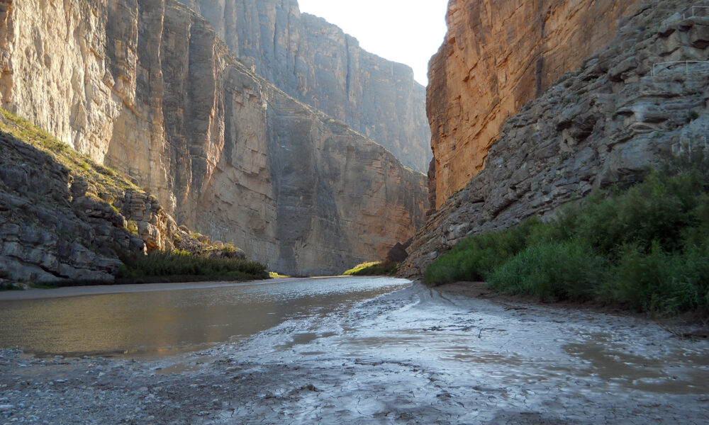

Update for October 13, 2026: If you are planning the Santa Elena Canyon Trail at Big Bend National Park, check the road closures before driving. In the National Park Service’s Big Bend Alerts & Conditions report updated October 6, 2026, the paved road between Cottonwood Campground and Santa Elena Canyon and Old Maverick Road were both listed as closed until further notice following dangerous conditions associated with previous flooding. Those are not routine trailhead inconveniences: they can prevent normal vehicle access to the canyon. This article does not claim the roads have reopened; verify a newer NPS update or speak to a ranger before you make the trip.
When access is available: This is a roughly 1.6-mile round-trip hike into the dramatic Rio Grande gorge on the Texas–Mexico border. The NPS trail-place page lists about 80 feet of elevation change and a typical hiking time of one hour, although the creek crossing and weather can make it considerably more demanding. The hike usually begins at the end of Ross Maxwell Scenic Drive and crosses the bed of Terlingua Creek before climbing steps into the canyon.
Below is a practical, source-checked guide to the route, parking, seasonal closures, actual creek-crossing hazards, fees and alternatives if the canyon is inaccessible. It separates the trail’s normal layout from conditions reported for October 2026.
Santa Elena Canyon Trail: quick facts
| Question | Official or practical answer |
|---|---|
| Where is it? | West side of Big Bend National Park, Texas, at the end of Ross Maxwell Scenic Drive |
| How long is the hike? | NPS trail-place page: 1.6 miles round-trip (2.6 km); another NPS overview rounds it to 1.7 miles |
| How much elevation change? | Approximately 80 feet (26 meters) on the NPS trail-place listing |
| Usual hiking time | About 1 hour under safe, passable conditions, plus stops |
| Difficulty | Short but not uniformly easy: a muddy creek bed, a steep bank, steps and rocks |
| Can you bring dogs? | No pets are allowed on park trails; qualifying service animals follow separate rules |
| Trail reservation? | No trail-specific reservation according to the NPS hiking listing; park admission applies |
| Facilities | Normally a small parking area and vault toilets at the trailhead |
| Current access warning | NPS October 6, 2026 road bulletin lists both main approach roads as closed until further notice |
Why the 1.6 vs 1.7 mile difference? The individual NPS trail listing says 1.6 miles round trip while the park’s River Hikes overview says 1.7. Those are two official rounded descriptions of the same out-and-back trail; neither should be treated as a distinct longer route. A third-party GPS app may show a slightly different track depending on where the recording starts and stops.
Important October 2026 alert: can you reach Santa Elena Canyon?
Do not plan the visit as though ordinary vehicle access is guaranteed. As of the NPS conditions bulletin last updated October 6, 2026, two relevant roads were explicitly closed: the paved approach between Cottonwood Campground and Santa Elena Canyon, and Old Maverick Road. The bulletin describes weather-related closures continuing until further notice. The listed closure is a road-access issue, not proof that every part of the walking trail is itself permanently closed.
What should you do before leaving your hotel or campsite?
- Open the official Big Bend current conditions page and look specifically for Santa Elena Canyon, Cottonwood Campground, and Old Maverick Road.
- Confirm the report’s last updated date. Information from October 6 could change later without notice to unrelated travel sites.
- If the notice remains unclear, ask a ranger directly. The park lists its main telephone number as 432-477-2251.
- Do not attempt to bypass gates, follow unmaintained creek beds, or assume a road is passable because a navigation app draws a route.
- Prepare a backup day in the park that does not depend on access to the closed road segments, and confirm the replacement trail or viewpoint is open too.
Do not conflate “Big Bend National Park is open” with “this trailhead is reachable.” Park entrances can operate while individual roads, campgrounds, and trails are inaccessible.
Where exactly is the Santa Elena Canyon Trail?
Santa Elena Canyon sits in the southwestern part of Big Bend National Park, along the Rio Grande at the international boundary. The trail follows the U.S. side of the river into a narrow limestone gorge. The cliff on the opposite side is in Mexico, which makes the landscape visually striking but does not mean this is a legal international crossing. Remain on the designated U.S. route and follow all park rules.
Under normal conditions, visitors drive the Ross Maxwell Scenic Drive toward Castolon and the Santa Elena Canyon trailhead. NPS describes Ross Maxwell as an approximately 30-mile scenic drive with geological and historical stops. The drive itself is part of the experience: Sotol Vista and Mule Ears are among the well-known viewpoints along the road, subject to current availability.
Are there two ways to drive to the trailhead?
Park maps show both a paved approach from the Ross Maxwell/Castolon side and an approach along Old Maverick Road, an improved but rough dirt road. In normal conditions, the paved route is preferable for most conventional vehicles. Old Maverick may be washboarded, muddy after rainfall and slow even when open. In October 2026 both routes were listed closed in the NPS bulletin. Do not treat the dirt road as a legal or safe workaround for a paved-road closure.
Parking and restrooms
NPS pages agree that the trailhead has parking, vault toilets and picnic facilities, but they are inconsistent about whether the parking surface is paved: the trail-place page describes parking for about 20 vehicles, while the activity page says the parking lot and trailhead are not paved. Treat the surface description as uncertain and focus on the confirmed points: capacity is limited, the creek bed and trail are uneven, and access depends on current road conditions. Never park in a way that blocks emergency access.
The hike step by step: what the actual route is like
Knowing the route before you go is more useful than relying on a “short and easy” label. Santa Elena is compact, but water at the creek is a genuine trip-changing obstacle.
1. Begin at the trailhead and assess Terlingua Creek
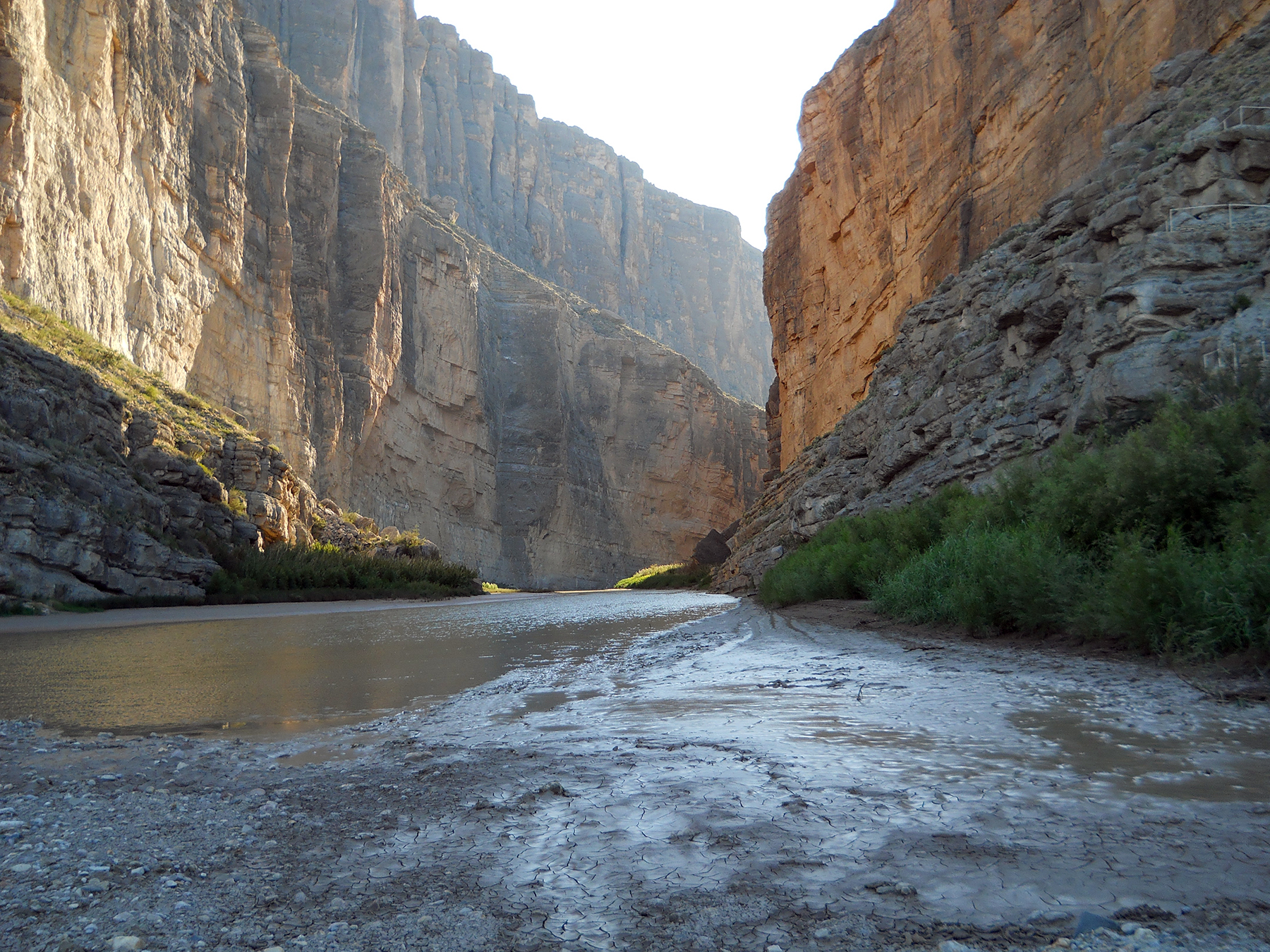
From the trailhead, the maintained route heads toward the bed of Terlingua Creek. This is the first decision point. When dry, it may be sand; after rain, it can be sticky mud or flowing water. The NPS warns that people sometimes wander far upstream to avoid wet feet and end up beneath dangerous cliffs. That is not the maintained route. If water is deep, swift or rising, turn around rather than improvise a crossing.
2. Climb the bank and the steps
After the creek crossing, the trail climbs a short, steep sandy bank and a series of paved or concrete steps. This is where much of the concentrated effort occurs despite the trail’s modest overall elevation-change figure. Stop at designated spots to view the canyon and river, keep children close, and do not scramble onto exposed ledges.
3. Descend into the canyon
After the elevated viewpoint, the route drops toward the river and curves between imposing canyon walls. Riverside ground may be rocky, sandy or muddy depending on river levels. The NPS describes the walk as continuing among large boulders until the cliff and river leave no further trail.
4. Turn around at the designated end
This is not a through-hike. When the maintained path ends where the canyon wall meets the Rio Grande, return along the same route. You will need to cross the Terlingua Creek bed a second time, which is why weather observations matter even when you begin in dry conditions.
5. Leave more time than the headline estimate when needed
The official one-hour average is only a planning reference for favorable conditions. Photo stops, a cautious creek crossing, slower hikers and heat all add time. There is little benefit in racing the clock near steep banks or rising water.
Creek-crossing and flash-flood safety
Water risk matters more than mileage. The NPS specifically warns that the trail can become impassable because of Terlingua Creek flooding. Rain upstream can produce dangerous conditions even if the skies immediately above the trail look clear. The canyon narrows and riverbank escape options become limited.
| What you find at Terlingua Creek | Safer decision |
|---|---|
| Dry sandy bed; NPS confirms access | Stay on the marked alignment, monitor conditions and proceed only within your ability |
| Thick mud; uncertain footing | Assess carefully; avoid unstable edges and do not force an unsafe crossing |
| Flowing water, especially deep or swift | Do not cross, per NPS; turn around |
| Recent heavy rain or flood forecast | Consider postponing; consult park staff about present conditions |
| Road closure or barricade | Do not drive around it; choose an authorized alternative |
The NPS guidance to carry about one liter of water per person per hiking hour is a starting point rather than a maximum. Bring extra in hot weather, drink regularly, wear sun protection and carry salty snacks. Big Bend’s desert air can dry sweat quickly, so the absence of visible sweat does not prove that you are adequately hydrated.
What shoes work best?
Closed-toe footwear with reliable grip is more useful than sandals because of muddy creek edges and rocks. NPS notes that shoes can get muddy; pack a change for the car if needed. Do not step into moving water solely to keep another pair of shoes clean.
Is the trail suitable for young children?
That depends on the child’s ability, the adult’s supervision and the conditions that day. NPS lists the outing as recommended for ages 10 and up in its activity listing, always with responsible adult supervision for children. The creek, drop-offs and steep section are more important than the distance alone. Turn back promptly if the conditions are unsuitable.
When is the best time to hike Santa Elena Canyon?
When the access roads are open and the creek is safely crossable, many visitors prefer fall, winter or spring for more manageable temperatures compared with extreme desert summer heat. However, “cooler season” does not guarantee an open road or dry crossing. Big Bend can have rain events, cold nights and variable river conditions throughout the year.
For a hot day, choose cooler daylight hours, check the park’s weather information, and bring more water than the minimum. The NPS recommends daylight for the trail because it runs alongside a river and involves uneven terrain. After storms, seek a ranger update instead of relying on photos from a previous season.
Can you go at sunrise or sunset?
Visitors may normally access the park during all hours, but the NPS specifically advises hiking Santa Elena during daylight for safety. In a narrow gorge, cliffs can shade the trail and make its footing harder to read near sunset. If your route requires a potentially muddy creek crossing, give yourself substantial daylight for both directions.
Fees, permits, reservations and dogs
The Big Bend NPS fee page lists a $30 entrance pass for a private, non-commercial vehicle, valid for seven days, and a $55 Big Bend annual pass. Fees and eligibility for other passes can change, so use the current NPS page rather than an old screenshot. The trail activity listing says there is no separate Santa Elena Canyon hiking reservation. A park entrance pass does not override a road closure.
The NPS forbids pets on hiking trails in Big Bend. A visitor who brings a dog to the park should check allowed roadside areas rather than assuming the canyon trail accepts leashed pets. Service animals have separate applicable rules. Overnight camping, guided river activity, and boating/rafting are governed by rules beyond this short day hike; do not treat a hiking entrance pass as a rafting permit.
Can you visit the canyon without hiking the full trail?
Under normal access conditions, visitors can appreciate the canyon from roadside interpretive and overlook areas without walking all the way into the narrowest section. The NPS lists a Santa Elena Canyon Overlook and a nearby interpretive exhibit. Their access is nevertheless dependent on the relevant roads. As of the October 6, 2026 alert, do not assume these viewpoints are reachable by car.
Is Santa Elena Canyon wheelchair accessible?
The deep-canyon trail is not a wheelchair-accessible path: the creek crossing, uneven natural surface and steps prevent step-free continuous access. A developed overlook or exhibit may offer a more accessible experience when open, but confirm the exact accessible features with NPS before traveling. Accessibility is site-specific; accessible parking does not mean every adjoining hiking route is accessible.
How is Santa Elena different from an Arizona slot canyon tour?
Santa Elena Canyon is a natural riverside hiking experience in a U.S. national park, with conditions controlled by the river and creek; it is not generally a timed, guided commercial slot-canyon tour. If you are considering another canyon trip, our Antelope Canyon location and tour-access guide explains the separate requirements for Navajo-guided visits near Page, Arizona. Do not transfer Antelope Canyon’s tour rules, fees or schedules to Big Bend.
Similarly, do not confuse the short hiking trail with boating the length of Santa Elena Canyon. The broader canyon spans miles, and river trips require separate planning, suitable equipment and park permits.
Practical checklist before you go
- Check the NPS closure notice for the paved Cottonwood–Santa Elena road and Old Maverick Road.
- Check Terlingua Creek with a ranger; do not cross deep or fast-flowing water.
- Read a weather forecast including the possibility of storms beyond the trailhead.
- Carry water, sun protection, snacks and appropriate footwear.
- Allow a margin of daylight and keep your group together.
- Do not bring pets onto the trail.
- Do not substitute a blocked road or an unmarked creek route for the official trailhead.
- Confirm the park entrance pass and plan backup activities that are actually open.
Frequently asked questions
Is Santa Elena Canyon Trail open in October 2026?
The NPS conditions report last updated October 6, 2026 lists the paved road between Cottonwood Campground and Santa Elena Canyon and Old Maverick Road as closed until further notice. That means ordinary access may be blocked even though the park itself is open. Check the newest NPS alert before any attempted visit; we do not claim the roads have reopened.
How long is the Santa Elena Canyon hike?
The official trail-place listing gives 1.6 miles round-trip, while the NPS River Hikes page rounds it to 1.7 miles. It is an out-and-back route, not a loop.
How much time do you need?
The NPS describes an average hiking time of about an hour under favorable conditions. Allocate additional time for safe creek crossing, photos, slower companions and seasonal heat.
Is there a waterfall at the end?
No. The highlight is the sheer limestone gorge and the Rio Grande riverbank. The maintained route ends where a canyon wall meets the river, not at a waterfall.
Do you have to cross water?
You cross the bed of Terlingua Creek. It may be dry, muddy or flowing depending on rainfall. NPS says do not cross if water is deep and swift.
Is parking free?
The normal trailhead parking area does not require a separate trail reservation, but entry to Big Bend generally requires the appropriate park entrance pass. Parking availability and access remain subject to road closures.
Can a passenger car drive to the trail?
In normal conditions the paved approach is generally the choice for standard cars. Do not rely on that advice during the reported October 2026 closure. Old Maverick Road is a rough dirt road and was also reported closed.
Can you take your dog to Santa Elena Canyon?
No pets are permitted on Big Bend’s hiking trails. Follow the NPS guidance on service animals if applicable.
Is Santa Elena Canyon in Mexico or Texas?
The Rio Grande forms the border. The usual NPS hike enters the canyon from the Texas side; the opposite side of the gorge is in Mexico. The trail is not an official border-crossing route.
Official sources and update notes
- Big Bend National Park — Alerts & Conditions: October 6, 2026 road-closure bulletin, creek warning and ranger contact details.
- NPS — Santa Elena Canyon Trail: length, elevation change, parking, creek crossing and safety.
- NPS — Hike Into Santa Elena Canyon: trail characteristics, no-pets rule and access guidelines.
- NPS — Ross Maxwell Scenic Drive: normal route and main stops.
- NPS — Fees & Passes: vehicle and annual pass amounts.
Editorial review: October 13, 2026. We reviewed NPS trail information and its October 6 closure bulletin. We did not visit or test the road in person, and we are not asserting the route’s current walkability. Always check the NPS alert immediately before travel.

Other Articles

Minecraft Commands Guide: Essential Cheats for Java and Bedrock