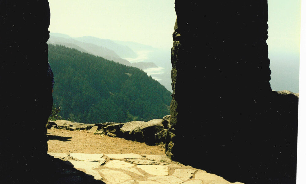

Quick answer (October 13, 2026): Cape Perpetua Overlook is a high viewpoint on Oregon’s central coast in Siuslaw National Forest, roughly two miles south of Yachats. The headland rises about 800 feet above the Pacific Ocean and is described by the U.S. Forest Service as the highest viewpoint on the Oregon Coast reachable by car. You can either drive up a winding forest road to the day-use parking area or hike the Saint Perpetua Trail from near the visitor center. At the top, the short Whispering Spruce Trail leads toward the historic stone West Shelter and spectacular coastline views.
This practical guide separates the overlook from the broader Cape Perpetua Scenic Area, explains the drive and walk, and flags the parking, facilities, fog, fees and coastal hazards that short social-media descriptions often miss. For changes on your travel day, use the Siuslaw National Forest’s official Cape Perpetua page.
Where is Cape Perpetua Overlook in Oregon?
Cape Perpetua is on the coast of Lincoln County, immediately south of the small town of Yachats and north of Florence, along the U.S. Highway 101 corridor. The overlook sits near the top of the forested headland, not at the highway-level visitor center. Visitors looking for the best elevated view should navigate specifically to Cape Perpetua Overlook Day Use rather than stopping at the first coastal parking pullout.
The U.S. Forest Service manages the approximately 2,700-acre Cape Perpetua Scenic Area and describes approximately 26 miles of trails through coastal temperate rainforest, rocky shorelines and hillside habitats. The overlook is one stop within this larger area.
Overlook, visitor center and Devil’s Churn: three different places
| Place | What you will find | What to plan for |
|---|---|---|
| Cape Perpetua Overlook Day Use | High coastal panorama, summit-area walks, West Shelter access | Drive a winding upland road or hike uphill; fog may block the view |
| Cape Perpetua Visitor Center | Information, exhibits when staffed, lower trailheads and ocean-view deck | Hours and open/closed status may change; it is not the summit |
| Devil’s Churn / Restless Waters area | Steep rocky shoreline and intense wave action | Separate lower coastal access and potentially dangerous surf |
| Cook’s Chasm / Thor’s Well area | Rocky shore, spouting features and tidepooling opportunities | Check tide and weather; do not approach dangerous edges |
Do not treat one parking fee, open trailhead or accessible path as a guarantee that every facility in the scenic area is functioning. Choose the location matching your activity and check current Forest Service site notices.
How to drive to Cape Perpetua Overlook
From Highway 101 near the Cape Perpetua Scenic Area, follow posted signs for the Cape Perpetua Overlook and the paved summit access road. The drive climbs inland through forest before reaching the high day-use parking lot. The small road has bends and elevation gain, so drive conservatively and watch for bicycles, hikers, fallen branches and low visibility.
- Start in Yachats: travel south on U.S. 101 toward Cape Perpetua, watching for the Forest Service scenic-area entrance signs.
- Identify the overlook road: distinguish the upper viewpoint access from the lower visitor-center, shoreline and campground access points.
- Follow posted conditions: seasonal closures, construction or winter storms can alter access. If the road is gated, do not drive around a barrier.
- Park in a legal space: display or pay any required day-use permit according to the current sign at the location.
- Walk toward the view: follow marked overlook or Whispering Spruce paths, respecting any closures and sensitive vegetation.
Because GPS apps sometimes drop a pin at the larger scenic area rather than the summit lot, it helps to have an offline map and read the road signs. The U.S. Forest Service describes the overlook as accessible by car, not as a location directly visible from Highway 101.
Is the drive suitable for a regular car?
In normal open-road conditions, a standard roadworthy passenger car can access the overlook via the designated road. You do not need an off-road vehicle for a routine visit. However, storm debris, snow, ice, maintenance or temporary restrictions may change safe access; do not rely on a statement of year-round roadway availability without checking the latest notices.
Can you drive an RV to the viewpoint?
A winding uphill route and a comparatively small day-use area can make large vehicles challenging. Check Forest Service parking rules and your vehicle’s turning radius before entering. If your RV is long or towing, the lower highway-level sites may be more practical. Never block a gate, turnout, fire access or trailhead.
The West Shelter and Whispering Spruce Trail
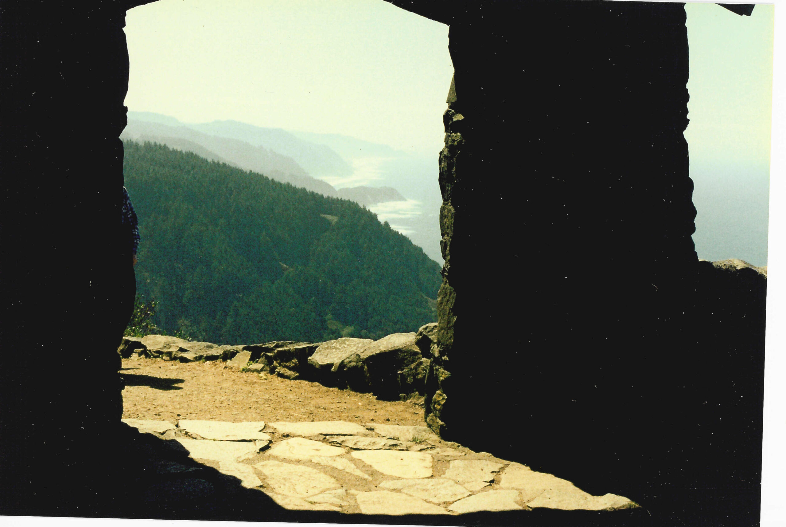
The summit parking area is a short walk from the viewpoint and the historic stone West Shelter. The shelter and nearby stone parapet were built during the Civilian Conservation Corps era in the 1930s and provide a memorable foreground for photographs of the coastline. Local and regional visitor organizations describe the shelter as a place later used for coastal observation, including during World War II.
The Whispering Spruce Trail is a short summit loop, roughly 0.3 mile according to several regional trail guides. Its viewpoints face the ocean and forested slopes; the canopy can make the walking conditions damp even on a dry morning. The U.S. Forest Service identifies the trail as #1306 and describes accessible sections. Accessibility of the entire route and surrounding viewpoint facilities should be confirmed for your particular needs and current conditions.
How long do you need at the overlook?
For a quick stop, 20–45 minutes can be enough to park, visit the main viewpoint, photograph the coast and walk the short summit path. Leave extra time for fog to shift, for a picnic, or for photography. On busy days it may take longer to find a legal space. This is a planning suggestion, not a trail completion guarantee.
What is the view like on a clear day?
The overlook is approximately 800 feet above the ocean, offering a broad perspective over the forest, coastline, U.S. 101 and the protected marine shore. A Forest Service site description syndicated through OuterSpatial says sight lines may extend nearly 40 miles out to sea and along 70 miles of coastline in ideal clarity. Treat such figures as best-case visibility, not what you are guaranteed to see in coastal fog or rain.
Hiking up instead: Saint Perpetua Trail
If you want the ascent rather than only the view, the Saint Perpetua Trail climbs from the visitor-center side of the scenic area to the overlook. It winds through old-growth coastal forest, ferns and slopes before meeting the upper trail network. Compared with driving, this option demands more time, effort and appropriate footwear.
Regional guides describe it as approximately 2.8 miles round trip from the lower visitor-center area, with roughly 700–770 feet of uphill elevation gain. Distances can vary slightly by the chosen start point and whether you add the Whispering Spruce loop. Use current on-site signage as the primary authority for mileage.
Is the trail easy?
It is not a flat beach path. The climb involves sustained elevation gain, switchbacks, damp roots and possible mud. Many reasonably fit hikers can enjoy it, but someone seeking a minimal walk should use the summit parking area instead. After heavy rain, slopes can be slippery; bring stable shoes and allow a generous turnaround time.
Can I combine the upper loop with the forest trail?
Yes, where routes are open and signed, you can reach the summit on Saint Perpetua Trail and then make a short circuit along Whispering Spruce before returning the same way. Confirm the junctions on the current Forest Service map. Do not assume a loop shown on an old hiking app remains open after storm damage or maintenance.
Parking fees, passes and what to bring
Some Cape Perpetua day-use areas require a parking fee or valid pass. A common published rate is $5 per vehicle for day use, and Northwest Forest and qualifying federal passes may be accepted at relevant Forest Service fee sites. However, fee locations, valid passes, payment methods and rates can change; read the sign at your specific parking area rather than treating a blanket online quote as definitive.
At the high overlook, plan as if drinking water is unavailable. Nearby facilities at the lower visitor-center area do not mean there is a working water source or staffed building at the summit. Bring a bottle, a warm layer and rain protection even if Yachats feels comfortable.
| Item | Why it matters |
|---|---|
| Parking fee payment or suitable pass | Rules vary by Forest Service day-use site |
| Rain shell and warm layer | Exposed windy conditions at the viewpoint |
| Water and snacks | Limited facilities at the high day-use area |
| Sturdy walking shoes | Potentially wet paths and slippery roots |
| Offline map | Navigation among the overlook, lower visitor center and coastal stops |
| Phone or camera with a clean lens | Sea spray and mist often coat glass |
| Binoculars | Scanning the distant water and rocky coastline |
Best time of day and year for a Cape Perpetua view
The best view depends more on visibility than the month. Clear breaks between coastal cloud layers can reveal the long shoreline panorama, while fog may hide almost everything beyond the closest trees. Morning can be moody with marine-layer mist; later afternoon can produce warmer side lighting if the sky opens.
There is no guaranteed perfect month. Spring and autumn may bring changeable weather, summer can have dense coastal fog despite dry inland conditions, and winter often features powerful surf and storms. For photography, check local cloud forecasts, wind and travel advisories rather than simply selecting the sunniest temperature forecast.
Is sunset a good idea?
On a clear evening, low light over the Pacific can be striking. Leave enough time to return to the car before dark, especially if walking the forest trail. Use the posted day-use opening and closure times; do not infer that all lots permit overnight parking from a general scenic-area description.
Can you see whales from the overlook?
Possibly. The Oregon Coast is known for whale watching, and elevated, clear-day viewing may make distant blows more visible. Sightings depend on season, sea state, visibility and luck. Bring binoculars and be patient; the overlook is a scenic viewpoint, not a guaranteed guided wildlife attraction.
Don’t confuse the overlook with Thor’s Well
Thor’s Well is a dramatic coastal rock feature in the Cape Perpetua region, but it is not on the overlook summit. It lies near the lower Cook’s Chasm shoreline area, approached by different trails and parking. Similarly, Devil’s Churn is a wave-carved inlet accessed from a lower scenic-area section. Each is worth researching separately, especially because ocean conditions there are more hazardous than at the upland overlook.
For a safe first visit, prioritize the high viewpoint and designated trails. Waves can unexpectedly wash far across low rocks. Sneaker waves, slippery algae, unpredictable surge and incoming tides have injured people at Oregon’s rocky coast. Stay well away from unprotected edges and never move toward a spouting feature for a closer photo as a wave is arriving.
When should you visit tide pools instead?
Tide pools are more appropriate at lower, signed shoreline access during a safe low-tide window. Ask local staff about permitted exploration areas, respect the Cape Perpetua Marine Reserve, and avoid stepping on fragile organisms. A summit-only visit is not a tidepool hike.
Accessibility, pets and family visits
Because the overlook parking is near the viewpoint and the Whispering Spruce trail has Forest Service-described accessible sections, Cape Perpetua can offer views without requiring the long Saint Perpetua ascent. Nevertheless, accessibility depends on parking, pavement, grades, surface condition, restrooms and any temporary closures. Verify these details with the Forest Service before planning around a wheelchair or mobility aid.
Keep children away from ledges, unprotected slopes and wet rocks. Stay on signed routes around historic structures. Dogs may be allowed on designated Forest Service trails subject to leash and wildlife rules; regional guidance describes a six-foot leash. Always use posted site requirements. Clean up after pets and pack waste out.
What about the visitor center?
Published Forest Service general descriptions say the visitor center is staffed most of the year, with reduced winter hours; some local updates have also reported temporary closures. Because the notices are not always dated consistently, do not promise an open visitor center on your travel date. The summit overlook can be the primary destination even if exhibits or programs at the lower center are unavailable, provided the upper road and day-use area are open.
Cape Perpetua Overlook itinerary: a realistic two-hour visit
- First 15 minutes: From Yachats, follow Highway 101 toward the Cape Perpetua area, verify upper access, then park legally at Overlook Day Use.
- Next 30 minutes: Visit the high viewpoint, notice the relationship between the forested headland and the shoreline, and take photos when clouds permit.
- Next 25 minutes: Follow the marked short Whispering Spruce route and see the West Shelter if open. Read any historical interpretation.
- Next 20 minutes: Enjoy a packed snack or additional viewpoint time; do not leave food scraps.
- Final 30 minutes: Return by the access road, allowing more time if weather or traffic changes. An additional trip to Devil’s Churn or the visitor center is a separate extension, not guaranteed within two hours.
For hikers approaching from below, replace this quick itinerary with enough time for the full uphill and downhill Saint Perpetua Trail, and confirm posted parking hours at both ends.
Common planning mistakes to avoid
- Navigating only to the visitor center: the lower center is not the 800-foot-high summit viewpoint.
- Expecting the water to be visible in all weather: coastal fog can erase distant scenery.
- Assuming parking and facilities are free/open: pay required day-use fees and read current closures.
- Using Thor’s Well as an alternative safe viewpoint: the shoreline location has very different exposure to surf.
- Relying solely on an old trail map: forest storm damage and maintenance can change the route.
- Arriving without a layer: wind can feel much colder 800 feet above the water.
- Ignoring the photo’s date: historical scenic photos show landforms and outlooks but cannot demonstrate current trail or facility status.
Frequently asked questions
Where is Cape Perpetua Overlook?
It is in Siuslaw National Forest on the central Oregon Coast, just south of Yachats, above Highway 101. Navigate to the Cape Perpetua Overlook Day Use parking area rather than the lower visitor center.
How high is Cape Perpetua Overlook?
The headland reaches about 800 feet above the Pacific, according to the U.S. Forest Service.
Can you drive to the Cape Perpetua Overlook?
Yes, under normal open-road conditions the Forest Service designates it as the highest Oregon Coast viewpoint accessible by car. Follow the signed winding access road and current advisories.
How long is the walk from the parking lot?
The principal viewing area is a short distance from the summit parking. For a more substantial walk, follow the roughly 0.3-mile Whispering Spruce loop, subject to signed route availability.
Is Cape Perpetua Overlook the same as Thor’s Well?
No. Cape Perpetua Overlook is the high forested viewpoint. Thor’s Well is a hazardous rocky shoreline feature in the broader scenic area near Cook’s Chasm.
Is there an entrance fee?
Certain day-use parking areas charge a fee or accept qualifying passes; $5 per vehicle is widely listed, but check the current official site and the payment sign before assuming an exact amount.
Can you see the coastline if it’s foggy?
Sometimes near slopes remain visible, but dense fog can fully obscure the panorama. If visibility is poor, wait only if it is safe and the parking area remains open.
Can you camp at Cape Perpetua?
There is a designated Cape Perpetua Campground near Cape Creek, managed separately from the day-use overlook. Check official Recreation.gov information for campground descriptions, actual site availability and reservation rules.
Are dogs allowed at the viewpoint?
Dogs may be allowed on suitable forest trails with leash and cleanup requirements. Follow posted signs and current seasonal wildlife restrictions.
Official sources and photo license
- U.S. Forest Service — Cape Perpetua Scenic Area: area size, height, driving access, overlook day-use site, trails and visitor facilities.
- Recreation.gov — Cape Perpetua: campground location, general amenities and recreation information (specific sites and calendars vary).
- Travel Oregon — Cape Perpetua Scenic Area: trail and visitor information, current day-use fee guidance.
- Yachats Visitor Organization — Hike Cape Perpetua: Saint Perpetua and Whispering Spruce route context.
- Wikimedia Commons — South from Cape Perpetua 01.jpg: photograph by Joe Mabel (August 1992), available under CC BY-SA 3.0. The photo has been uploaded to the AVARIXO media library, but it is Joe Mabel’s work, not an AVARIXO original; no attribution logo has been added to the pixels.
AVARIXO editorial note, October 13, 2026: Forest Service road and trail notices, visitor center access, fee details and weather may change. This is a researched planning guide, not a firsthand trail test. Check the Forest Service and posted site information on the actual day you visit.

Other Articles