
Quick answer (October 2026): Browns Canyon National Monument is a rugged protected landscape beside the Arkansas River between Buena Vista and Salida, Colorado. Entry to the monument itself is free, but some nearby Arkansas Headwaters Recreation Area (AHRA) parking, boat-launch and campground facilities charge separate fees. For hikers, Ruby Mountain is the main access point; for boaters, Ruby Mountain and Hecla Junction are important river access sites. The best first visit depends on whether you want an easy riverside walk, a longer backcountry hike or a guided whitewater trip. Always check road, weather and river conditions before leaving.
Browns Canyon National Monument at a glance
| Question | Practical answer |
|---|---|
| Where is it? | Chaffee County, central Colorado, along the upper Arkansas River between Buena Vista and Salida. |
| Entrance fee | No general admission fee to the national monument; specific AHRA facilities may require a Colorado Parks and Wildlife (CPW) pass or additional fees. |
| Best hiking access | Ruby Mountain Trailhead, reached by a dirt-road approach from U.S. Highway 285. |
| River access | Ruby Mountain for launch and Hecla Junction for a common take-out; plan any float with current river conditions. |
| Managed by | U.S. Bureau of Land Management (BLM) and U.S. Forest Service; CPW manages river recreation through AHRA. |
| Is a 4×4 required? | Not for every route, but all land approaches use unpaved roads. Aspen Ridge Road and Turret Road call for high-clearance four-wheel drive. |
| Winter road closure | Forest Service Road 1434A closes seasonally from December 1 to April 15, according to BLM. |
The BLM’s monument guide is the authoritative starting point for its geography, routes and rules. The Friends of Browns Canyon visitor resources add useful access details, but do not replace the agencies’ current restrictions.
Where is Browns Canyon, and is it a national park?
Browns Canyon was designated a national monument on February 19, 2015, protecting approximately 21,589 acres of mountain and river country. It is not a National Park Service site with a staffed entrance gate, a single visitor center and paved roads throughout. Management is shared by BLM and the U.S. Forest Service, while CPW manages boating and river-access recreation through the Arkansas Headwaters Recreation Area.
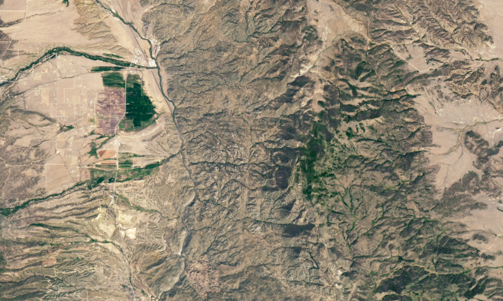
The monument lies east of the Arkansas River and west of the higher peaks of central Colorado. Its defining terrain includes granite outcrops, forested slopes, steep gullies, wildlife habitat and stretches of the river corridor. It is a place to plan a specific activity, not somewhere to drive through and expect a conventional roadside sightseeing loop.
How to get to Browns Canyon: choose the correct access point
Ruby Mountain: the main starting point for hiking
The Ruby Mountain area is at the northwest corner of the monument, accessible via County Road 300 from U.S. Highway 285. The trailhead serves several walking routes that enter the Browns Canyon Wilderness Study Area. It is generally the simplest choice for visitors who want to hike rather than arrange a river trip.
Parking nuance: Friends of Browns Canyon distinguishes the free Ruby Mountain hiking trailhead parking from nearby AHRA recreation-site services such as camping and boating, which carry fees. BLM’s broad fee summary describes CPW passes for Ruby Mountain Recreation Site parking or services. Because signs and designated lots determine what you actually use, follow the posted instructions on arrival and verify charges with CPW Arkansas Headwaters Recreation Area before parking or launching.
Hecla Junction: river take-out and a shorter walk
Hecla Junction lies farther south, reached using an unpaved approach from U.S. Highway 285. It is the primary take-out for many Browns Canyon float trips. It also has an AHRA campground, restrooms and a trail near the river. The road is steep and unpaved, making it a poor choice for a large vehicle in uncertain conditions.
Aspen Ridge and Turret Road: remote four-wheel-drive access
Aspen Ridge Road (Forest Service Road 185) follows the monument’s eastern side, while Turret Road (Forest Service Road 184) reaches interior scenery. BLM recommends high-clearance 4×4 for Aspen Ridge; Turret Road is rugged as well. Vehicles must remain within one vehicle length of the road when parked in the stated zones. These should not be described as easy shortcuts to a trailhead.
There is also an ATV route along the northern boundary (FSR 1434A), with a published annual gate closure of December 1–April 15. Other seasonal or emergency restrictions can differ. Obtain the current road information before navigating with a map app: an unpaved road on a map is not confirmation that a standard rental car can safely pass.
Best Browns Canyon hikes: distances and who they suit
The BLM lists several routes from Ruby Mountain and Hecla Junction. Distances below are round trips from the published visitor guide, not one-way mileage. Times are estimates, not promises; rocky terrain, heat, altitude and navigation can lengthen any walk.
| Hike | Published round trip | Estimated time | Good choice for |
|---|---|---|---|
| Seidel’s Suckhole Trail from Hecla Junction | 2 miles | 1.5 hours | A relatively short riverside out-and-back |
| Turret Trail to Little Cottonwood river area | 2.7 miles | 2 hours | A shorter hike with canyon scenery |
| River Bench Trail | 5.5 miles | 3 hours | More time on foot and an Arkansas River overlook |
| River Access Trail | 9 miles | 4.5 hours | Prepared hikers wanting a longer outing |
| Catkin Gulch Loop | 11.5 miles | 5 hours | Experienced hikers planning a substantial day |
For a first visit, select a route based on daylight, water supply and how much uneven trail you are comfortable with. The shorter Seidel’s Suckhole option is useful if river access and a low-commitment outing matter more than elevation gain. The River Bench Trail is a stronger fit for walkers who have several hours and want an overlook. The Catkin Gulch Loop requires more preparation and leaves less room for delays.
Can you mountain bike the hiking trails?
Not generally. Trails within the Wilderness Study Area prohibit mechanized travel, including mountain bikes. BLM and Friends of Browns Canyon identify limited routes for mechanical recreation elsewhere, including the Hefley Saddle Trail and Turret Road. A trail that permits hikers should not automatically be treated as bike-legal. Check the applicable current map and signs for the exact route.
Rafting Browns Canyon: what the difficulty labels mean
Browns Canyon is best known for rafting the Arkansas River. Guides often describe the run as predominantly Class II–III rapids, with harder conditions possible at higher flows. That shorthand does not mean the river is suitable for every inexperienced group. Its speed, hazards and cold-water exposure change with discharge, recent storms and seasonal conditions.
Should a beginner choose a guided trip?
For many first-time rafters, yes. A qualified local operator can explain current river levels, equipment, minimum age, swimming ability and what the itinerary actually includes. Ask whether the proposed route passes through Browns Canyon, where the trip launches and ends, and what happens if conditions make the planned run unsuitable.
What about an unguided trip?
Private boaters should examine the current CPW river information, check flow data and know how to self-rescue. Do not infer a safe water level from another season’s video or a general guide. A properly fitted personal flotation device, knowledge of river hazards and an appropriate group are essential. The normal float logistics include a vehicle shuttle: a car at the launch does not help if the boat finishes miles downstream.
Use the CPW/AHRA official information for boating rules, permits and closures. For rafting, commercial fees are paid to the operator; a free national-monument entrance does not mean a guided float is free.
Browns Canyon fees in 2026: why ‘free’ can be misleading
The monument itself has no entrance charge. That is distinct from charges for particular state-managed amenities. Your actual cost depends on what you do and where you park, camp or launch a boat.
| Activity | Fee situation |
|---|---|
| Enter Browns Canyon National Monument | No general entrance fee. |
| Use the designated Ruby Mountain hiking trailhead | Friends of Browns Canyon describes limited free trailhead parking; verify signage and lot boundaries. |
| Use AHRA parking, boat ramps or developed facilities | May require a CPW day or annual pass or relevant activity fee. |
| Reserve an AHRA developed campground | Camping fees and reservations apply. |
| Book a commercial rafting trip | Operator price varies by trip and conditions. |
Do not assume a federal America the Beautiful pass substitutes for every Colorado state-managed recreation charge. Check CPW’s current pass requirements rather than quoting a price from a past year.
Camping, fires and wildlife
Developed camping areas at Ruby Mountain and Hecla Junction are managed through AHRA. Their campsite reservations and regulations are distinct from dispersed use elsewhere in the monument. Check specific rules before pitching a tent, and confirm whether river-accessed campsites or established-site restrictions apply to the itinerary.
Fire restrictions change with weather and local fire danger. A photograph of an old campfire ring is not evidence that you may light a fire today. Consult BLM, USFS, CPW and Chaffee County rules; use established sites, carry out trash and dispose of human waste properly. Browns Canyon is habitat for bighorn sheep, elk, black bears, raptors and other wildlife. Observe animals from a distance and never feed them.
When is the best time to visit Browns Canyon?
Late spring through early fall is generally the most convenient period for trail access, while the strongest rafting demand follows mountain snowmelt. Summer outings call for sun protection and plenty of water. Autumn can be attractive for walking, but daylight is shorter and high-country weather can change quickly.
Visiting in October 2026
An October hiking trip is possible in suitable weather, but do not depend on an unrestricted driving route, commercial rafting availability or warm river conditions. BLM lists a seasonal December–April gate closure on FSR 1434A, yet other storm, wildlife or maintenance restrictions may occur sooner or independently. Treat the published seasonal rule as a baseline, not as today’s all-clear.
Is Browns Canyon a dark-sky destination?
Yes. Browns Canyon gained International Dark Sky Park recognition in 2024, reflecting the area’s low light pollution and conservation work. A night visit still requires safe access, a weather check, legal parking and awareness of wildlife. Dark-sky designation is not permission to camp or drive where ordinary restrictions prohibit it.
A practical first-visit plan
- Choose one activity. Decide whether your priority is hiking, rafting or vehicle-accessible scenery, since each uses different access points and demands different preparations.
- Confirm the route. Review BLM/USFS road notices, the AHRA status and the official monument map. Do not choose a rough four-wheel-drive road based solely on a phone route preview.
- For a day hike: start at Ruby Mountain, check the correct parking area and pick a route appropriate to your fitness and daylight.
- For rafting: confirm water levels, launch/take-out points, operator or private-boating requirements and a shuttle.
- Pack for self-sufficiency: bring offline navigation, water, layers, rain protection and a way to leave the area safely if access conditions change.
- Check fees and fire restrictions on the day. No general monument admission fee does not remove state recreation-site charges.
If you enjoy planning less-developed protected landscapes, AVARIXO also covers Ironwood Forest National Monument’s remote roads and camping. If river scenery is your priority but you prefer a different kind of park visit, see our Great Falls Park overlook and trails guide. These are separate destinations with different access rules.
Frequently asked questions
Is Browns Canyon National Monument free to visit?
Yes, the monument has no general admission fee. CPW/AHRA amenities such as some parking, campgrounds and boat launches may charge separately.
Where is the easiest Browns Canyon trailhead?
Ruby Mountain is the main land-access trailhead for hiking. Reach it via a dirt-road approach and confirm weather and parking conditions before departing.
Can you drive all the way through Browns Canyon?
Do not plan on a conventional paved scenic drive. Access routes are unpaved, and interior roads such as Turret Road are rugged and better suited to high-clearance four-wheel-drive vehicles.
Is Browns Canyon rafting safe for beginners?
Difficulty changes with water flow and the specific run. Many newcomers choose qualified local guides; even then, confirm age, fitness, equipment and river conditions before committing.
Can you camp at Browns Canyon?
Yes, but the permitted option and fee depend on the exact location. AHRA developed sites involve reservations and charges, while dispersed or river camping has separate rules.
Are Browns Canyon trails open in winter?
Some access may be possible, but roads and trails can be affected by snow, weather and seasonal gates. FSR 1434A has a published December 1–April 15 annual closure. Verify all routes before travel.
Last editorial review: October 15, 2026. Confirm conditions with BLM, monument access updates, and Colorado Parks and Wildlife. This guide does not claim to have visited the site or tested the trails.